* A short walk in the Stubai: day 2: Aperer Turm
Today's adventure is available as a GPS track.
 This was a half day together; we were to climb to the Rinnensee, and perhaps the Rinnenspitze; and (I secretly hoped) I might get M over the RinnenNieder. So, we started just after breakfast. Breakfast starts at 6:30 (except perhaps at the weekends or by special request) which is one way you can tell these are really walkers huts not climbers ones; by 6:30 it has been light for several hours; the real climbers get up at 4 am at this time of year. Having thought b'fast started at 6 we set the alarm for then, so have at least got time to get the sacs downstairs, etc. Over b'fast M realised she needed a restish day, so restricted her ambitions to the See.
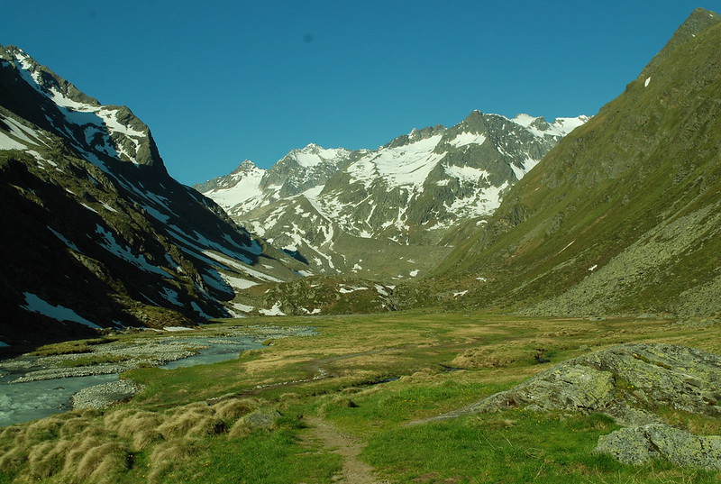
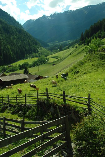
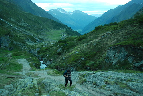
 The path to the See and Spitze diverges from the Starkenburger hutte path soon above the FSH, just at the stream / waterfall, in an uncharacteristically poorly marked way. My main pic shows a view down from the path to the deep gorge cut by the main stream, and to the half-way-alm (really, the 3/4 way Alm), the Alpeiner Alm, with its Resto that I've never visited. And the little pic is a view back to the FSH and upvalley. As you see, it was yet another hard blue sky day.
 At a semi-plateau at ~2500 m (ie, ~350 m up, ie about an hour in) there is a bench and picnic table in memory of "Harry Parkes Esq", an Englishman who loved to walk and climb in the beautiful Austrian Tirol. And indeed this spot does have a lovely view; and a picnic table is very English.
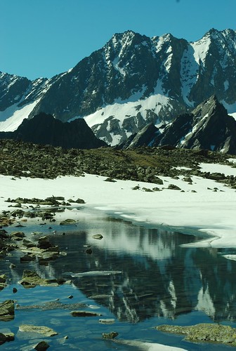 Just a little higher (M on the path up, Rinnenspitze on the skyline) up we come to the RinnenSee itself, nearly all frozen at this time of year. It is obligatory to photograph the opposite mountains reflected in the See, so here is my take. Other people have much more patience and wait for a totally windless day when the lake is ice-free and get nicer pix. Behind is the Sommerwand then the skyline may be the Nördliche Kräulspitze (3292 m); see here. But I've never been that way, alas.
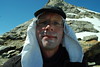 At this point the third sunny day in a row is beginning to tell on me - in fact yesterday, at the Aperer Turm, I was just a touch blase about the sun - so today I'm all cammed up and have put a lightweight tee-shift under my hat to shade me from the Heat of the Noonday Sun. Why don't they make hats that shade you properly? I bet the French Foreign Legion had them.
The book Trekking in the Stubai Alps has a reasonable section on this route - see google books. The map on p 113 is useful, as is the pic on p 114 - although be aware that the very top of the route is misleadingly drawn in: you go up to the col, and then the ridge on the skyline, to the L of the peak; not straight up the face. Or at least, I did. Which is what, to me, their description says. That book, also, talks of Bergschrund and Crevasses, none of which were in evidence in this snowy season.
Route markers: if you did the Aperer Turm, or one of the other semi-tourist routes, you'll have been amused or possibly exasperated by the number of route markers paint-splashed onto the rocks (unless, of course, you did the route in cloud or mist or when half the markers are covered in snow; then you'll have realised why there are so many and been grateful for them). Don't expect to have your hand held for you when you get higher up. Once over the RinnenNieder you can expect no route marking at all, which is as it should be. Although I have a clear, but possibly false, memory that the base of the PlattigeWand ramp was marked in 2001.

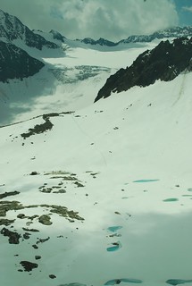
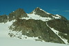 At the RinnenNieder, you are presented with a wide and glorious view of the LisenserFerner, with the LFK on the skyline; and if you swivel your head, a view down the glacier north to Praxmar. Very likely you will, like me, find a set of footsteps to follow in the snow. And quite possibly, like me, you'll discover that you're actually following a Chamois not a person after a while. Well, I reasoned, they probably know better than people where the pitfalls are.
Below the LFK you can see, foreshortened, the RotGratFerner. It looks fairly gently sloping from here... it doesn't look nearly so shallow when you get to it.
So, you trudge (or skip lightly, according to mood and snow conditions) over and then up the LisenserFerner (pausing to admire the view back to the RinnenSpitze and col), and the PlattigeWand looms over you, looking very wall-like. But you continue up the glacier, and eventually the obvious weakness - a ramp rising back- becomes obvious, and you follow it up. In 2001 it was snowless. At the top there is some lovely rock that would surely be climable was it less remote; and you may look forward to your way ahead. The snow from here to the col is moderately steep and in one place has a moderately interesting run-out.
[NOT FINISHED BUT SAVING NOW]
Today's adventure is available as a GPS track.
This was a half day together; we were to climb to the Rinnensee, and perhaps the Rinnenspitze; and (I secretly hoped) I might get M over the RinnenNieder. So, we started just after breakfast. Breakfast starts at 6:30 (except perhaps at the weekends or by special request) which is one way you can tell these are really walkers huts not climbers ones; by 6:30 it has been light for several hours; the real climbers get up at 4 am at this time of year. Having thought b'fast started at 6 we set the alarm for then, so have at least got time to get the sacs downstairs, etc. Over b'fast M realised she needed a restish day, so restricted her ambitions to the See.The path to the See and Spitze diverges from the Starkenburger hutte path soon above the FSH, just at the stream / waterfall, in an uncharacteristically poorly marked way. My main pic shows a view down from the path to the deep gorge cut by the main stream, and to the half-way-alm (really, the 3/4 way Alm), the Alpeiner Alm, with its Resto that I've never visited. And the little pic is a view back to the FSH and upvalley. As you see, it was yet another hard blue sky day.At a semi-plateau at ~2500 m (ie, ~350 m up, ie about an hour in) there is a bench and picnic table in memory of "Harry Parkes Esq", an Englishman who loved to walk and climb in the beautiful Austrian Tirol. And indeed this spot does have a lovely view; and a picnic table is very English.Just a little higher (M on the path up, Rinnenspitze on the skyline) up we come to the RinnenSee itself, nearly all frozen at this time of year. It is obligatory to photograph the opposite mountains reflected in the See, so here is my take. Other people have much more patience and wait for a totally windless day when the lake is ice-free and get nicer pix. Behind is the Sommerwand then the skyline may be the Nördliche Kräulspitze (3292 m); see here. But I've never been that way, alas.At this point the third sunny day in a row is beginning to tell on me - in fact yesterday, at the Aperer Turm, I was just a touch blase about the sun - so today I'm all cammed up and have put a lightweight tee-shift under my hat to shade me from the Heat of the Noonday Sun. Why don't they make hats that shade you properly? I bet the French Foreign Legion had them.The book Trekking in the Stubai Alps has a reasonable section on this route - see google books. The map on p 113 is useful, as is the pic on p 114 - although be aware that the very top of the route is misleadingly drawn in: you go up to the col, and then the ridge on the skyline, to the L of the peak; not straight up the face. Or at least, I did. Which is what, to me, their description says. That book, also, talks of Bergschrund and Crevasses, none of which were in evidence in this snowy season.
Route markers: if you did the Aperer Turm, or one of the other semi-tourist routes, you'll have been amused or possibly exasperated by the number of route markers paint-splashed onto the rocks (unless, of course, you did the route in cloud or mist or when half the markers are covered in snow; then you'll have realised why there are so many and been grateful for them). Don't expect to have your hand held for you when you get higher up. Once over the RinnenNieder you can expect no route marking at all, which is as it should be. Although I have a clear, but possibly false, memory that the base of the PlattigeWand ramp was marked in 2001.
At the RinnenNieder, you are presented with a wide and glorious view of the LisenserFerner, with the LFK on the skyline; and if you swivel your head, a view down the glacier north to Praxmar. Very likely you will, like me, find a set of footsteps to follow in the snow. And quite possibly, like me, you'll discover that you're actually following a Chamois not a person after a while. Well, I reasoned, they probably know better than people where the pitfalls are.Below the LFK you can see, foreshortened, the RotGratFerner. It looks fairly gently sloping from here... it doesn't look nearly so shallow when you get to it.
So, you trudge (or skip lightly, according to mood and snow conditions) over and then up the LisenserFerner (pausing to admire the view back to the RinnenSpitze and col), and the PlattigeWand looms over you, looking very wall-like. But you continue up the glacier, and eventually the obvious weakness - a ramp rising back- becomes obvious, and you follow it up. In 2001 it was snowless. At the top there is some lovely rock that would surely be climable was it less remote; and you may look forward to your way ahead. The snow from here to the col is moderately steep and in one place has a moderately interesting run-out.
[NOT FINISHED BUT SAVING NOW]