Wednesday 22 August 2018

Summer 2018: Dolomites: day 4: Agostini to valley

Previously: arrival and day 1: Graffer to Tuckett; day 2: Tuckett to Brentei; day 3: Brentei to Agostini.

Wednesday 22nd: day 4: Agostini to valley


GPS track.

Sleep well, woken by E telling me my alarm will go off in 30 seconds, which it does. Over breakfast, discover from pix on the walls that the huge blocks above the hut are from a tower that fell in 1957; and that the new roof dates from a very heavy snowfall in 2013/14. Pink morning with cap of cloud on a lower hill.

DSC_7925

We're heading for the Bocca due Denti. Off 8:15 in sunshine that slowly fades to light cloud. We grind up the #321.

DSC_7922

Befre we leave, a quick group portrait, perhaps the only one I have of all four of us from the trip. D, try to look happier.

DSC_7926

Near the start of the ladders, we saw parties to the left doing real climbing. Pix: distant, and closer. It was all very hard work:

DSC_7934

Near the top there is some weird grotto-like stuff, which was fun at the time but is in retrospect not terribly photogenic. An odd soft-looking contrast to all the sharp limestone. At the top we're out of the mist, and have a wide view down.

DSC_7940

A closer view, including the distant mast, which is Doss del Sabion, which is one way to get down from, but instead we chose to walk.

The descent is sort of over a series of shattered shelves / ledges in a scree-filled ex glacial basin. Looking back, you can see the "two teeth". And so to the hut, 11:15.

DSC_7949

Due to what I shall charitably regard as some misunderstanding about boots, I ended up sitting outside and Miriam brought me out a coffee. I go for a look at the chapel - every Italian hut has a chapel - which is carved into the rock, clearly visible from the hut.

DSC_7959

After that, one last look back at the weird rock in the mist,

DSC_7956

and we head back down towards greenery and sunshine once more.

DSC_7962

Here's a view back, from around about Val Nardis:

DSC_7971

D continues to look elegant when resting - but I've used up my quota of pix of him - and E doesn't quite cut it. That's the last of the pix: after that we go down and around Lago di val d'Agola and come to the head of the road, which we evade on the path for a few lacets. Then it absolutely pours with rain for perhaps an hour as we march stolidly down the valley, finding no shelter at all. At last, as the rain peters out, we come to a chalet-hotel-guest-house and nearly stop for tea, but she doesn't really do for non-guests, but tells us the cable-car is just down the road, so we go on to that. The cable is on the map, but not the stop; we get a quick lift (2E each) up all the way to Madonna. There's then some comedy as we struggle to escape the Giant Echoing Multi-Level Ski-Station-Cum-Car-Park which is really designed for winter. Once out, we find a decent cafe not far off and plot our next move.

Once we're feeling drier and warmer I leave my sac and march purposefully up through town to get the car, which takes half an hour or so and I arrive in plenty of time, though I was worrying I'd be late. By the time I drive back down, M has found us a hotel and... all is well.


Stoat

Tuesday 21 August 2018

Summer 2018: Dolomites: day 3: Brentei to Agostini

Previously: arrival and day 1: Graffer to Tuckett; day 2: Tuckett to Brentei.
Next: day 4: Agostini to valley.

Tuesday 21st: day 3: Brentei to Agostini


GPS: part 1: Brentei to Pedrotti; part 2: Pedrotti to Agostini.

Up 7 as before, woken by wise people setting off before us. D sleeps through it all. We're up in the roof again. Overnight rain, and lightning. Somewhat cloudier today.

A thought: unlike say the Roche Faurio, which I can visualise - even now, as I write this down several months in arrears - piece by piece, the via ferrata are more of a confusing mass that don't fit easily into any scheme in my mind. Or, as E said, you generally can't see your objective.

Off 8:10 initially up a pleasant, i.e. not too steep, path up to the obvious col, Bocca di Brenta. It's several km of nice walking, with great views, and the end in sight for once. This is because we started from the Brentei, not the higher Alimonta, so are skipping a section of the vf.

DSC_7836

Just before we get to the steep bit (a bit of snow, a bit of scree, a bit of ironwork that elsewhere would just be a path forced up the scree), we see three climbers on the Campanile Basso (more distant shot). From the top, it's very little distance to the "Tosa e Pedrotti". Pedrotti is the "real" hut; it's where M and I stayed a day or two all those years ago. We stop for drinks and cake; 9:50.

Pic: col to Pedrotti, with Tosa down on the left. The slightly odd low "wall" on the path alongside the rock wall protects their water pipe. View from the hut plus signposts.

DSC_7845

After half an hour head off, contouring round the Pozza Tramontana. Looking along our trail, WNW, from underneath Brenta Bassa towards the bulk of Cima Tosa, and somewhat rightwards the peak of Cima Margherita.

DSC_7855

Somewhat out of sequence, here's a view back, showing the Pozza Tramontana. Which is to say, the big hollow in the ground. The Pedrotti is not-quite-visible off to the left, but you can see the flattish area it is on and the path leading to it.

DSC_7869

Back to sequence. Here we're leaving the level to head up the scree.

DSC_7860

There were flowers, but rarely (some more, near the Agostini)

DSC_7861

Mostly it is limestone and so very dry and moonscape-y. But impressive.

DSC_7868

The col comes suddenly, because Cima Polsa is nearly level. M and D rest while E and I walk east along it. E stares south, into what is probably Val d'Ambiez.

DSC_7870

We're unsure what is next, but gear up anyway. That turns out to make sense, because the in-parts-quite-airy next section does the std looking-impossible-from-a-distance route across a face. Spot the people; may require enlargement.

DSC_7881

Descending towards the Vedr. d'Ambiez. Note red-roofed hut peeking out at the left. Also note impressive Giant Fractured Boulders that have fallen off something.

DSC_7888

The ladders were a bit airy too, disappearing over the edge into nothingness. Note gen-u-wine crevasses in the glacier behind.

DSC_7891

We had ice axes, and crampons - even if not enough for all of us, but had we needed them I'm sure we'd have managed - mostly "to be sure". As it turned out, there really was some glacier this time. However, the nice people had arranged a rope at the end of the ladders. So although you had to walk on a thin layer of gravel / stones / rubble on top of bare ice, with the rope as a handrail it was fairly easy not to fall over.

DSC_7901

After this the "official" route, apparently madly, goes across and slightly up the glacier, and descends the rock on the far side. I assert that this is due to the path-setters paranoia, and their desire to minimise your glacier-distance at all costs, so D and I pioneer a route down the glacier, which proves easy and pleasant, and we wave M and E down.

Looking back up. If you zoom in, there's a bloke in red on the rock band, so you can see where we came down (closer shot, so you can see more people).

DSC_7904

Coming out of the glacier basin we return to the true path, with the hut tantalisingly close but still several hundred meters below.

DSC_7911

It's a lovely afternoon. Sit around, play cards - floating bridge in the Dolomites - and enjoy the views. Signposts. The chef comes to take our dinner order.

DSC_7920

There are bolts on them thar boulders.

DSC_7921


Monday 20 August 2018

Summer 2018: Dolomites: day 2: Tuckett to Brentei

Previously: arrival and day 1: Graffer to Tuckett.
Next: day 3: Brentei to Agostini; day 4: Agostini to valley.

Monday 20th: day 2: Tuckett to Brentei


GPS track, part 1 and part 2.

Up 7, down to breakfast, D then M and E trickle in. We aim to leave at 8 and manage 8:15. M somewhat worried about the glacier at the start of today's route; I assert that it will be fine, in some way; and unlike most other parties are are at least carrying some crampons, even if not enough for everyone. But as I expected it turns out to be the sad moranic remains of a once proud Vedr. di Brenta Inf. Here we are approaching the pass, happily in the shade at this point; M and E on the left, D further on. We were not alone.

DSC_7731

Here's a view back from the top, for the situation of the hut. Or a zoomed-out view.

DSC_7737

At the top of the Bocca del Tuckett, 2613, we're just a hop over Cima Sella from connecting to yesterday's route before it headed down to the hut. At the col we put our gear on and proceed to the Ferrate aspect. On the far side, views down into the Val Perse and the cliffs of the Croz dell Altissimo. A little further round we can see lake Molveno and the town, which I think is where M and I started off decades ago when we visited the Dolomites.

DSC_7752

Today's via is a little harder than yesterday, but not much. As usual it's rather hard to capture the flavour in a picture; try clicking one and going through the sequences. At some point we were on the Sentiero Dorotea Foresti.

DSC_7763

DSC_7765

DSC_7760

The drops on the south side seem steeper than the north. At some point we realise that we're under Cima Brenta and that - given the number of people above us - it is probably climbable. Since it's 11:30 we have time, so I (and with some cajoling D) give it a go. But the ?Swiss? who are doing it are a party of ten and turn out to have secured themselves with a fixed rope. A little way up D and I realise that it is getting a little airy and we have no rope, and no real idea of how hard it is, so we beat a prudent retreat.

Not long after that we turn a corner to the Bocch. della Vallazza and can just see the red roof of the Brentei, far below (zoom). They don't want you littering. After a little section of ladders we come to the Bocca Bassa dei Massodi; from col down is the via Detassis.

DSC_7784

The path becomes a bit weird, and I think I lost track of exactly where we were... lots more ladders... and more... and more... 14 in all, and eventually it becomes clear that the ladders are avoiding a manky narrow steep scree / soil pile between two walls; here's a view back up to it (more distant).

DSC_7811

After that it's a fairly easy path down to the hut, which we reach around 5: a long day, but we all survived well. D as photogenic as ever, no-one else comes close.

DSC_7814

The rocks are also photogenic, and surreal.

DSC_7817

Lower down it starts to get green, and you realise how relentlessly rock it is higher up.

DSC_7821

Even flowers!

DSC_7822

Note that we're in the Brentei (2182), not the Alimonta (2580), because the Alimonta was full when the Tuckett phoned them for us this morning. That's kinda OK; the central section is rumoured to have suffered a collapse that might be annoying to get round; and we get a somewhat easier start to tomorrow by missing out the "central" portion, and so since we're all feeling good we skip a semi-planned reset day.

Dinner is good, preceded by playing bananagrams with an Italian woman at the next table, who does remarkably well given that she's playing in English. but we win :-).


Saturday 18 August 2018

Summer 2018: Dolomites: arrival and day 1: Graffer to Tuckett

Next: day 2: Tuckett to Brentei; day 3: Brentei to Agostini; day 4: Agostini to valley.

This is week 3 of the summer holiday: week 1 was the Ecrins (Miranda and I); week 2 was Italy Cultural (all of us; Turin, Florence; Venice) and week 3 is all of us doing via Ferrata in the Dolomites, and the drive back.

A note on the pix: I can't put them all up here. Click on any for enlargements, and then you can click through them all.

Next: Tuckett to Brentei.

Saturday 18th: Venice to Graffer


I did an early morning run in to Venice across the causeway, having recced it the day before, then walked (via the quieter Accademia sector) in the relatively cool morning to St Mark's square. I was there too early for the cathedral, so after a sit by the sea looking out I walked back, enjoying the city. After some faff we leave at 11, it is nominally 3 hours to Madonna di Campiglio, but who could have guessed it? Roads can get quite busy on a Saturday afternoon in summer. So we don't get there until nearly 4. That leaves us ever-so-slightly pressed for time: we drive down to just above the pedestrian bit where a little square has a shop to sell us a map and some chocolate, then back up to the Groste cable car carpark, where the last lift is at 5, and hastily do what we really should have done at leisure some much earlier time: sort through all our now rather jumbled kit for what we want to take and what we don't. We mostly get through this, I manage to leave behind my headtorch (but I don't need it) and fail to find my cap (so I wear my white "panama" instead, which is fine). We've negotiated 5 days parking - they seem oddly unfamiliar with the idea that people might want to do the via ferrata tour - but they want us to put the car in the "garage" for safety, happily this is just over the road, and so we get the 10-to-5 lift and we're on our way!

The lift is fun of course and sweeps us up. We have a moment of doubt if we're really supposed to get off at the mid station, but we are, so we do. Stop briefly for a bier and to adjust packs for walking. Then it's a half-hour walk up to the Rifugio Graffer. This was curiously quiet, which gave us a quite erroneous impression of how busy future refuges would be; I'm now pretty sure it is quiet because you can just as easily sleep down in Madonna, and get an early lift up.

DSC_7688

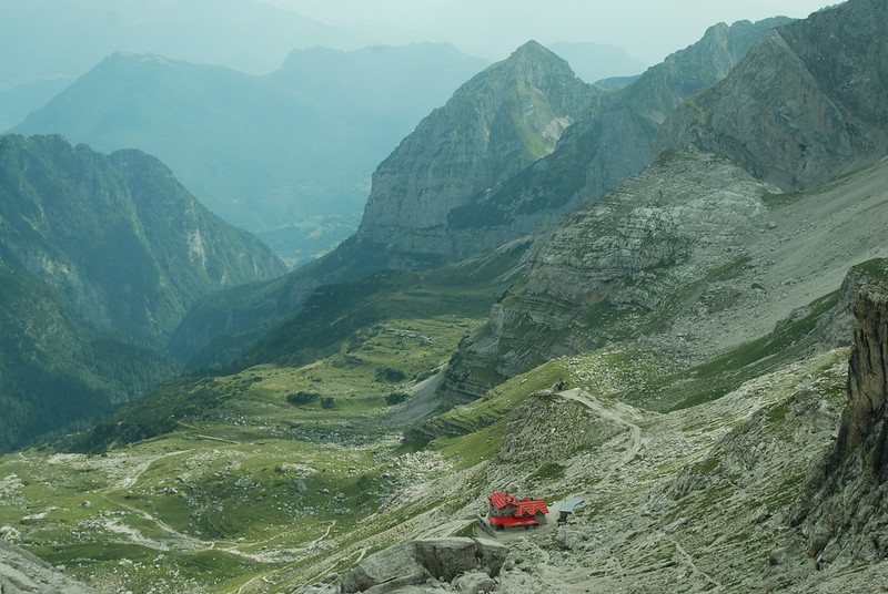
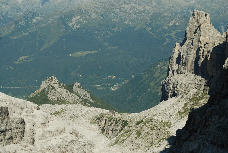
I'm reasonably sure this pic shows the view down from near the Graffer to the mid station.

Soir: decent meal, shower (3 euros!), cards, write. We have two 2-bed rooms, scrupulously clean as is the entire hut.

Sunday 19th: Graffer to Tuckett


GPS track. A bit more than 5 hours, a bit less than 10 km.
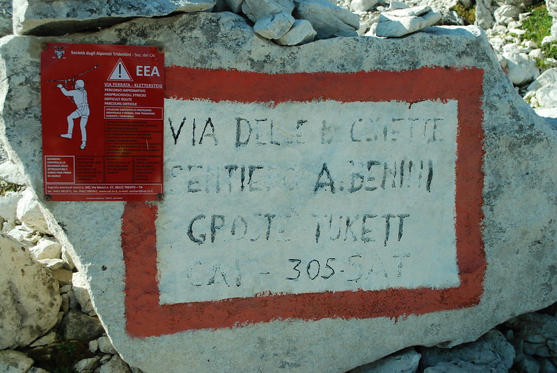
 Senterio Benini.

Room comfy overnight. Wake 6 due to noises off, up 7, b'fast in std hut style (tea-or-coffee-or-milk, bread-butter-jam-cheese-milk), pay E177 total, conveniently by card since cash is another thing we're slightly short of in our hurry (but don't be deceived: this was the only one that took cards).

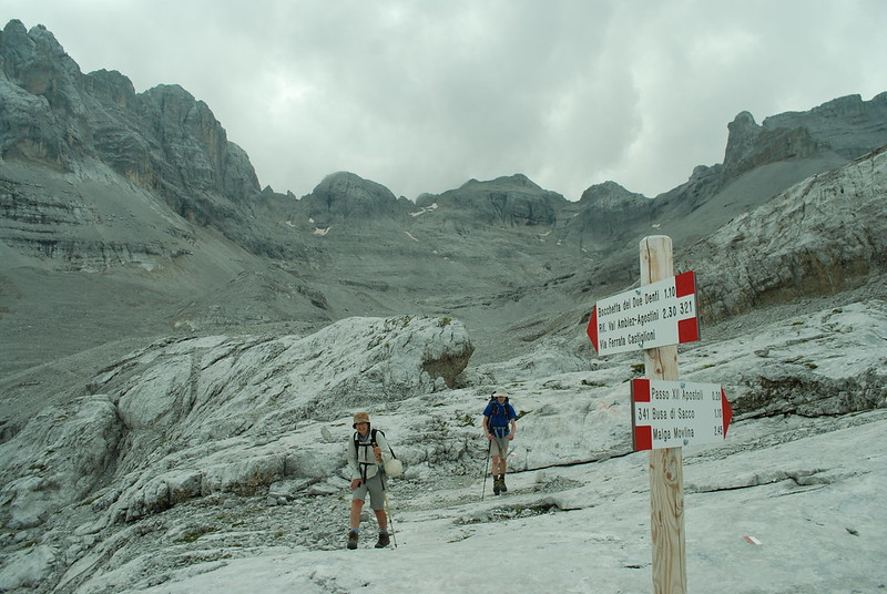
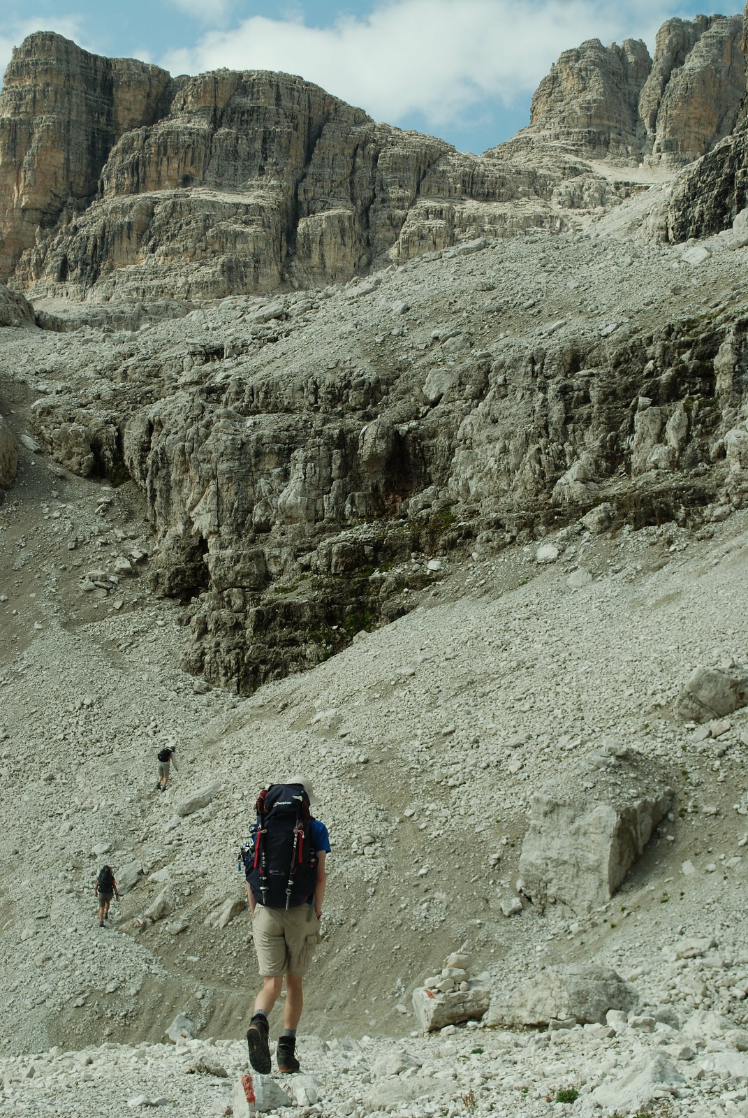
We're on the Senterio Benini. 305 is the long-distance route. You could probably survive without maps if you had to, the signs are generally good. Notice the nice red plaque telling you to how to via ferrata. I found today's route a bit confusing, once on the VF, in that it was hard to tell quite where we were, or where we would be going next. Sometimes you could see where you were heading, often not. Subsequent days were clearer, or perhaps I paid more attention to the route.

DSC_7692

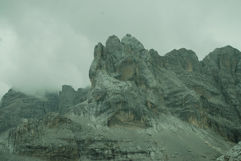
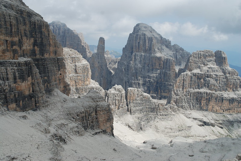
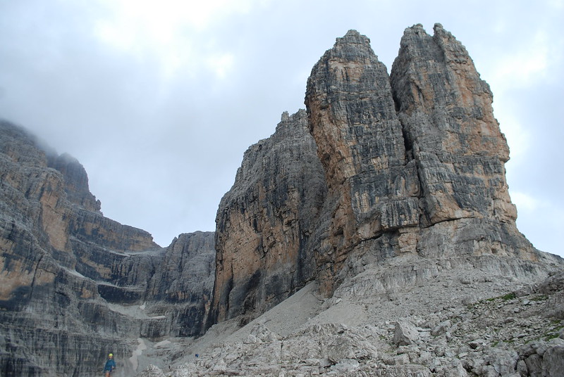
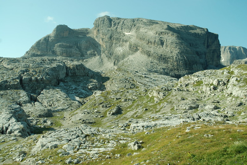
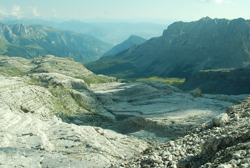
Cima Groste from the north, from not far off the cable car top station. It can be climbed, I later discover - probably up the central gully - but we didn't try to or even think about it. Our route goes up to the base of the central rubble fan, then rises gently leftwards to the skyline on the left, then curves round out of sight back rightwards behind the ridge where, if I recall correctly, the via ferrata starts with the ironmongery. The rock is impressive, alien-spaceship-like (actually it reminds me of this).

DSC_7691

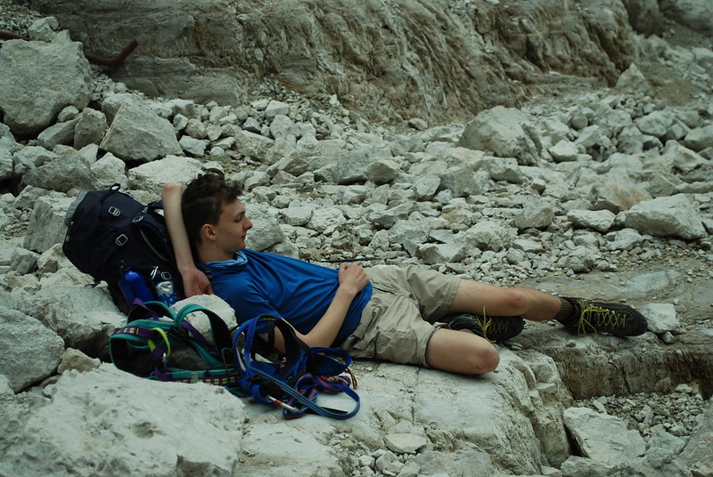
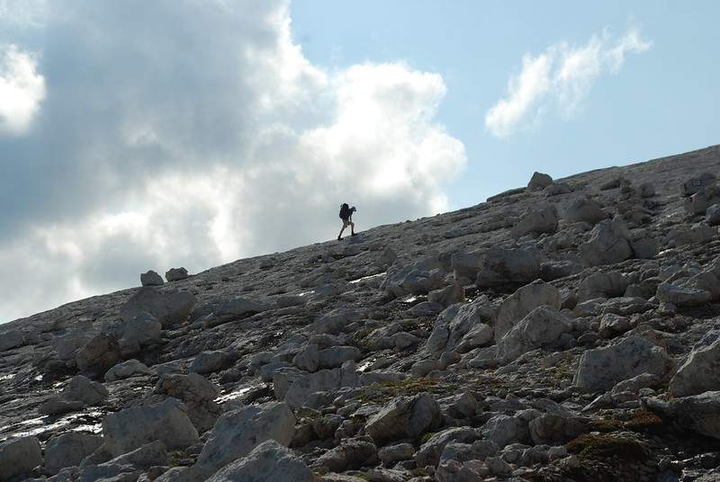
Daniel, of course, makes his own way:

DSC_7693

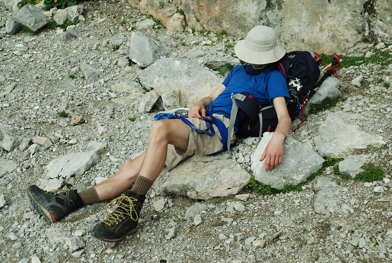
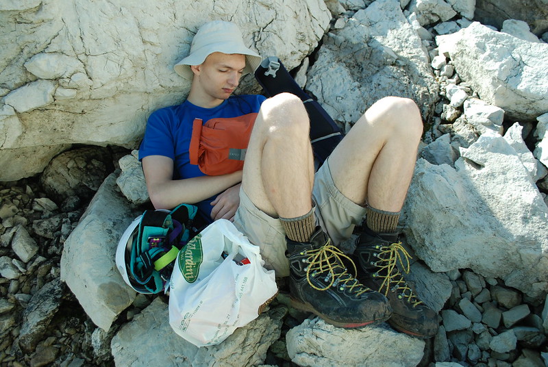
And is desperately photogenic when resting. He just folds up so well:

DSC_7694

The landscape is weird, here it looks poured, layered, like rice paddies of stone. This is from the shoulder in the previous picture, looking NEish, just before the VF starts properly.

DSC_7695

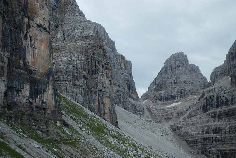
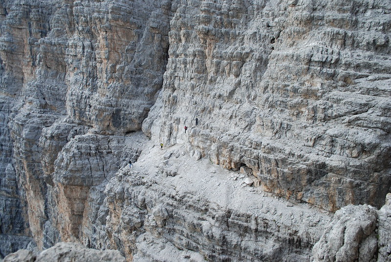
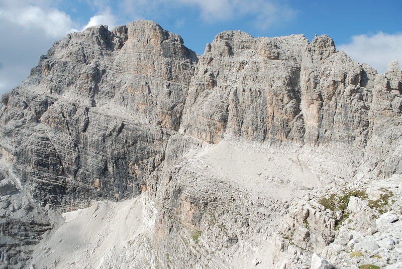
From the "corner" of Cima Groste, looking SSW to Cima Falkner. The path is the obvious line at mid-height rising leftwards; if you click for the hi-rez version you can see people to the L and to the R of the rubble slope.

DSC_7696

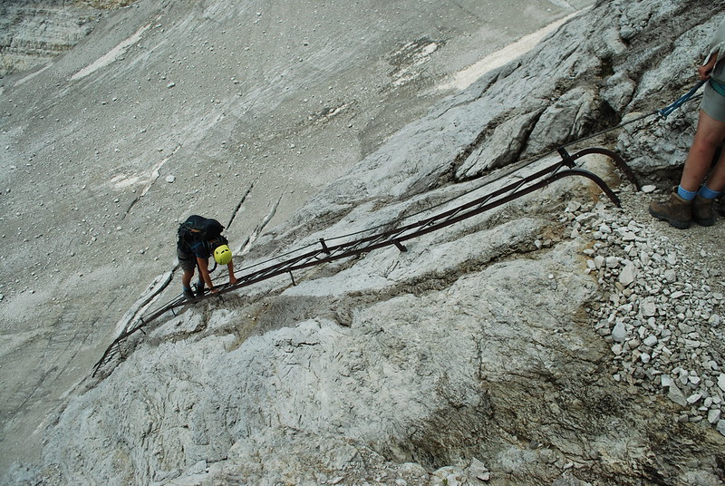
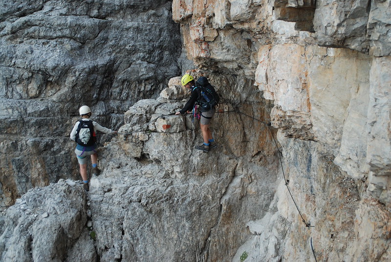
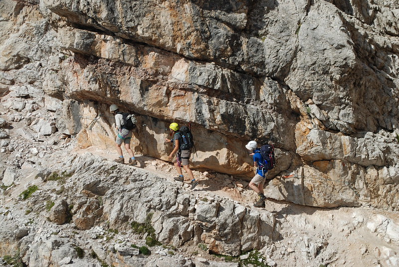
MED on a "typical" section, click-to-enlarge and you can see the cables and stuff. Here is it zoomed out for context.

DSC_7702

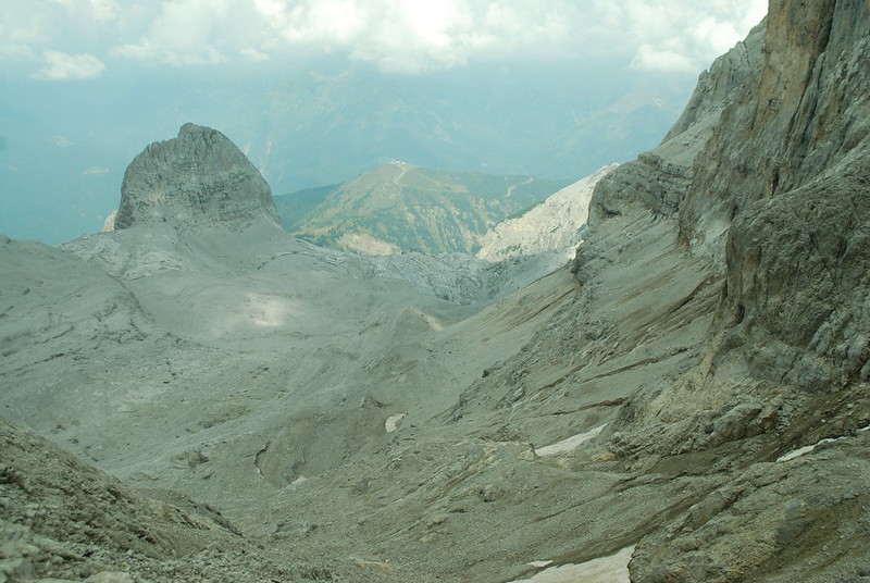
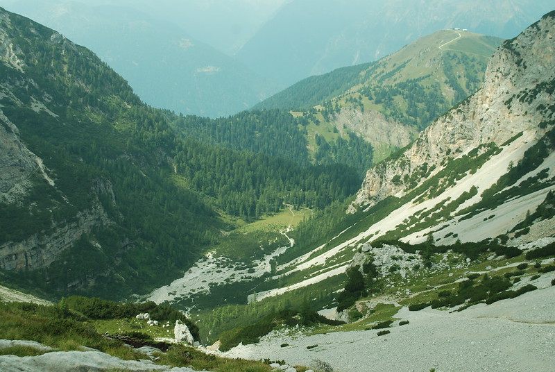
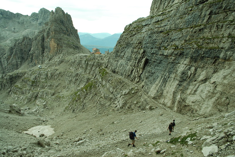
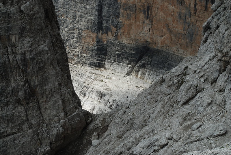
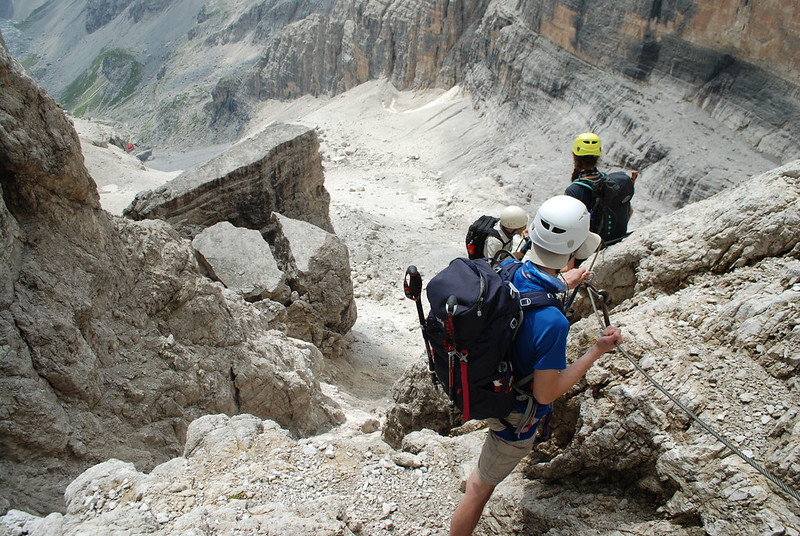
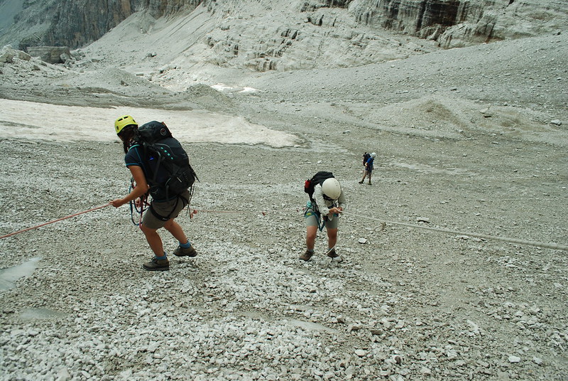
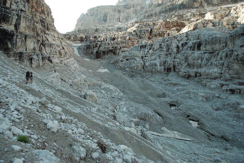
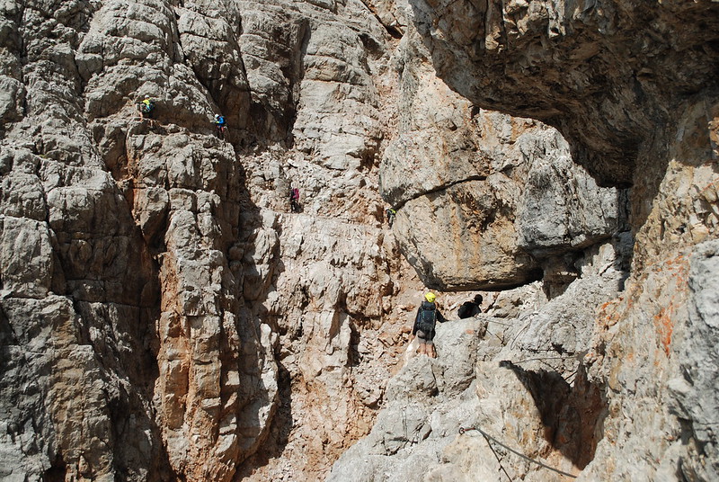
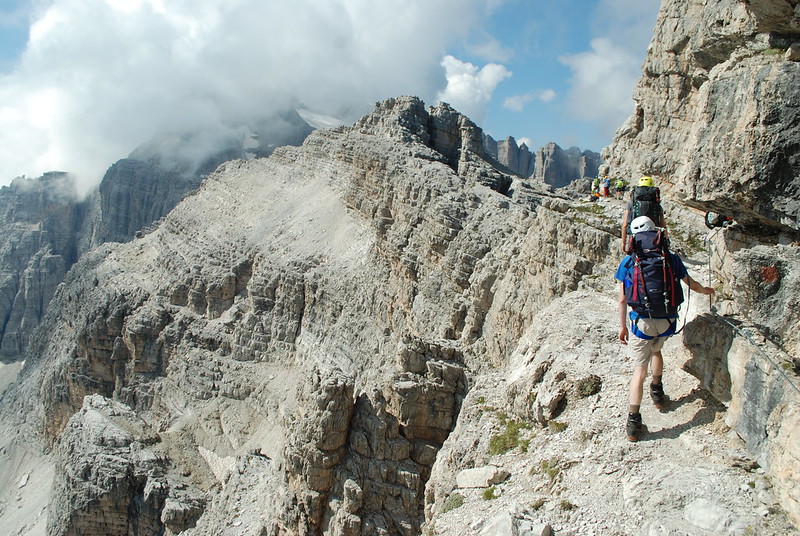
Somewhere around the Bocca alta di Vallesina things got particularly confusing, in terms of directions, but it sort-of didn't matter because we were heading down north into the valley towards Tuckett on path 315, and that worked. Here's a view from around about that point. D and E on the cable to the right, M's rucksac just visible. There was some kind of long descent, which I can't quite fit in - see pic, note crowds - which was pretty dramatic looking back (zoom in, spot-the-people).

DSC_7705

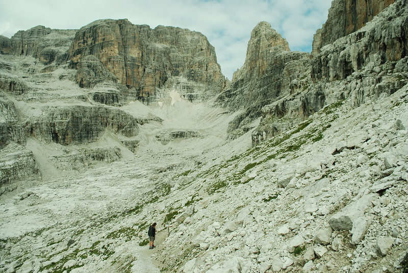
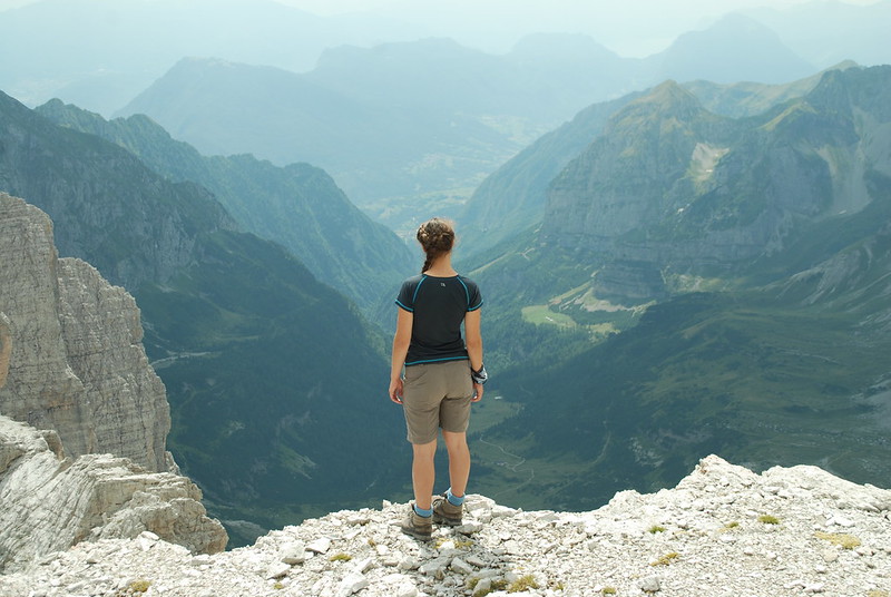
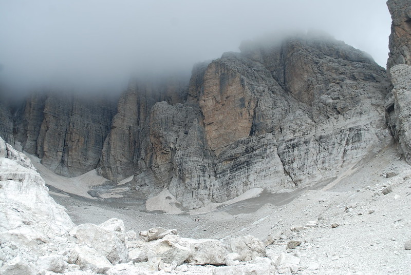
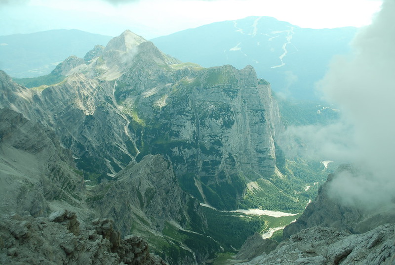
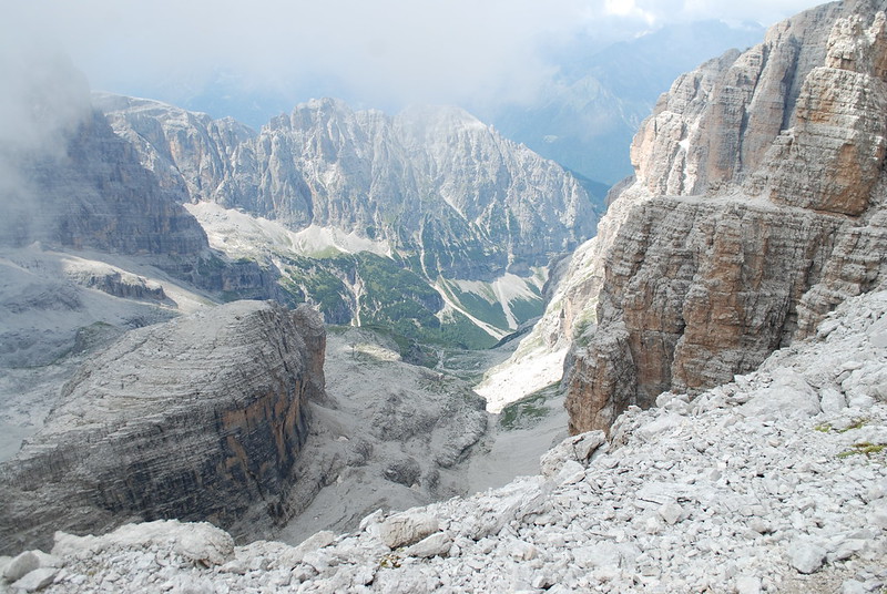
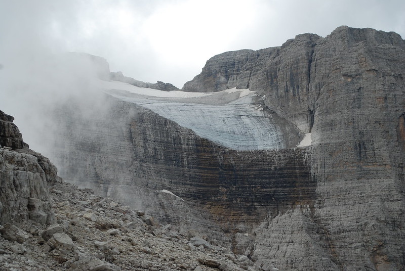
Round the corner and heading down, looking S to the hanging glacier on - I think - Cima Brenta.

DSC_7715

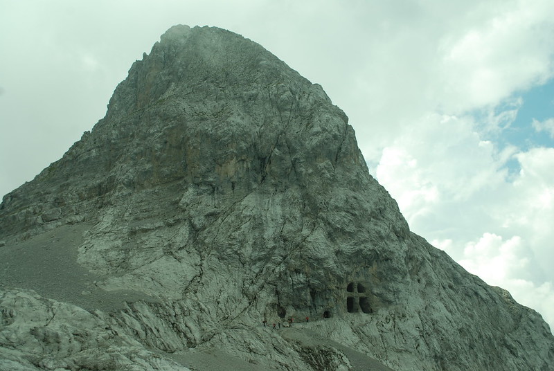
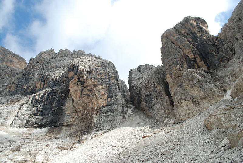
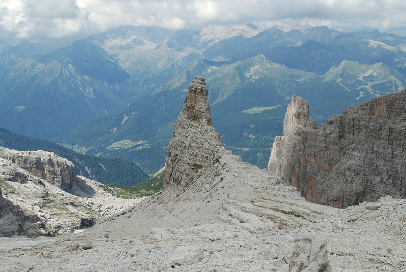
The Castelletto Superiore. Like a giants tower, with giant spiral steps leading to it.
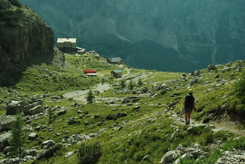
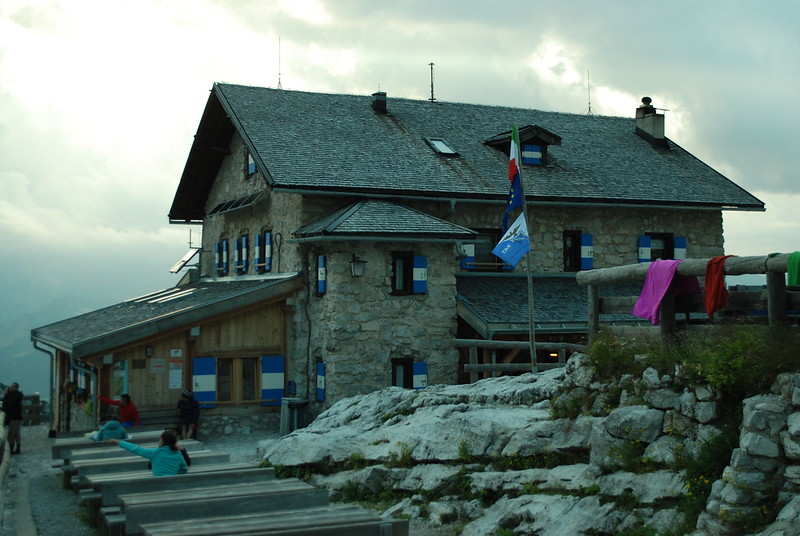
DSC_7716

Here's a view down towards the hut; and the hut itself, taken rather late in the day. We arrived at some sensible time like 2, but the place was heaving. We sat outside, I slept for quite a while with my hat over my eyes. They weren't quite sure if they would have space for us, and couldn't really say until late, maybe 8... but of course by the time we'd stopped for lunch and dinner it was too late to throw us out, and they did have space. But, the lesson is: book ahead. We end up with beds in the top of the second building. My cheeseburger for dinner was enormous, but good.

DSC_7724

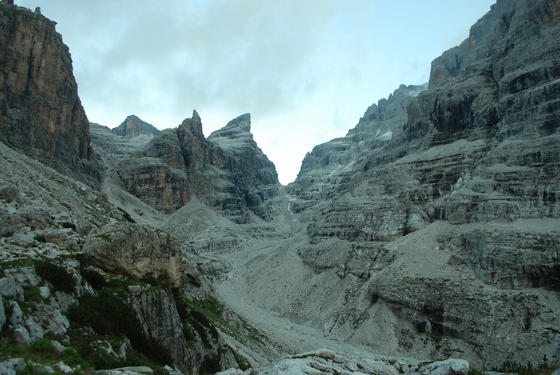
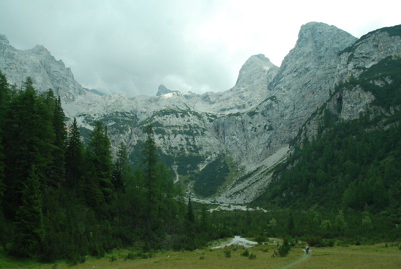
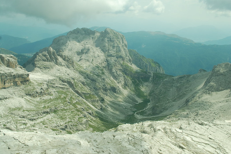
From the hut one can look back ESE up towards tomorrow's pass and today's route. The obvious notch is the Bocca Tuckett, tomorrow's route. Our path today was the valley not really clear to the L of that, L of the sharp tooth that is the Castelletto Superiore.

DSC_7723