Next: Sunday 7th: Sulzenau: rest day.
After the Zuckerhutl I went back from the Muller to the Nurnberger, and decided to try the Aperer Feuerstein, which is explained in full detail on the Nurnberger's website. As it says, its an interesting alternative to the path from the Bremer to the Nurnberger which I'd wimped out of a few days ago because it was cloudy and snowy and not a good day for venturing off the beaten track. But I was quite keen to look at the Feuerstein, and decided to be good by going for the Aperer first. Which made it a short day, so there was no need to get up early - ahem, but see later; I left around 8:30 with some hopes of visibility.
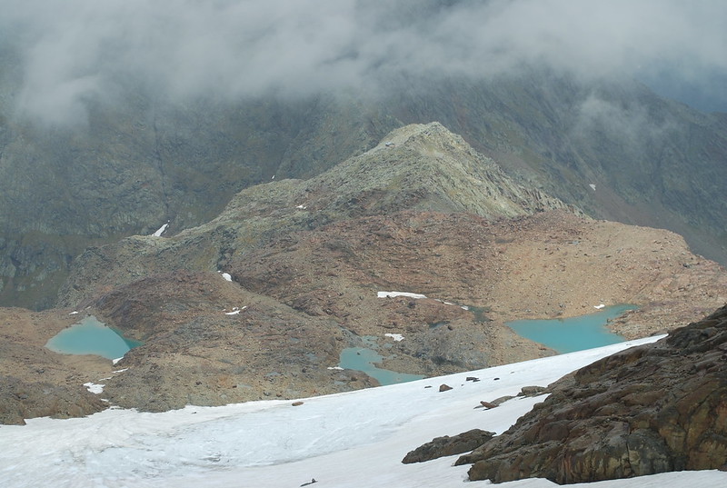
Before I show you the pix in order, here's an out-of-order pic of the Feuerstein group taken from the Niederl (the pass from the Nurnberger to the Sulzenau) at about 6 pm:
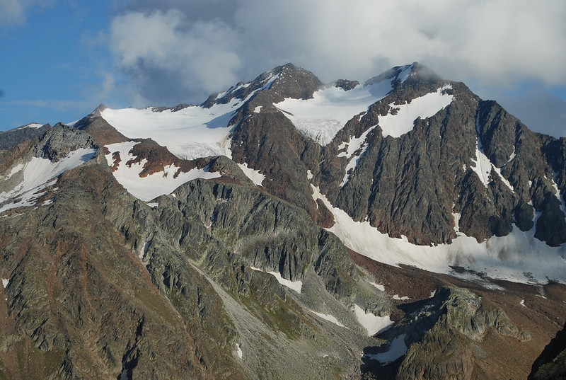
The skyline peaks are the Feuersteins: Westlich (3245 m, R) and Ostlich (3268 m, center). Its just about possible to see the summit cairn on the Aperer F in the full-size pix - its the greyish curvy ridge off towards the L just on the skyline; to its right is the distinctly redder pt 3038 not on the skyline, with the wide glacier to its R. The bottom of that pic - the snow patch in shadow at the R - is the top of the bowl visible in the top R of the pic below, which is taken from below as I walked up. Here's the GPS track for the circuit. I start off going down to the river as though to the Bremer, but then turn R up valley not L. I also have a slightly more informative picture from the afternoon return, when the cloud had cleared somewhat.
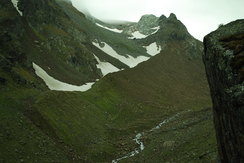
I'd expected the path up to the Feuerstein to be hard to find, but no. It is but a thread, but its clearly there; later I realise this is because of people going up to the Feuerstein itself. There's a rather nice path up the rather nice moraine - I like moraines. At the top of the moraine the path goes into the bowl inside the peaks on the R, then curls East and follows another moraine crest up, with the Grublferner to your R. At that point I'm in the cloud, and things become unclear.
At around 2770 m I lost the track and veered too much R wards. When I realised I'd lost it I waited for a break in the cloud - no dice - then just faintly heard a noise which turned out to be the tapping of a ski-stick on rock - it carries well, and is distinctive even at the limit of hearing. Moving in that direction I just saw a bod descending as he moved out of range, and so re-found the path.
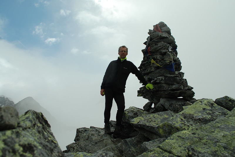
Somewhat later at 2900 m I'd gone too far East and would have ended up at pt 3038 m, except I met two bods who pointed out the error of my ways. In clear conditions I wouldn't have gone wrong, and if I had could just have cut across to the correct path; but in the cloud I descended (following them; I could have just retraced myself on the snow) and then found the correct path up. This wasn't helped by my now-20-year-old map having a very different shape to its glaciers; I really ought to get a new one. I leave my sack at the NurnbergerScharte - there's a cairn -, 2914 m, from where its a 15 minute scramble to the summit, 2968 m:
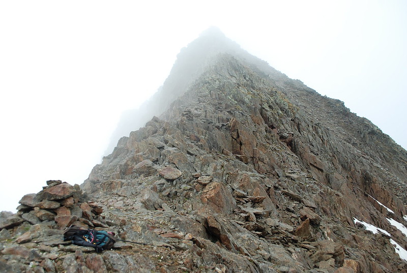
Views are still, well, here's the view up from the pass towards pt 3038:
But the views down exist. Here's looking towards the Simmingjochl, with the Zollhutte just distinguishable. What a difference a few days make: all the snow is gone. The lakes in the pic are shown as glacier on my map; but the glacier has retreated over the years.
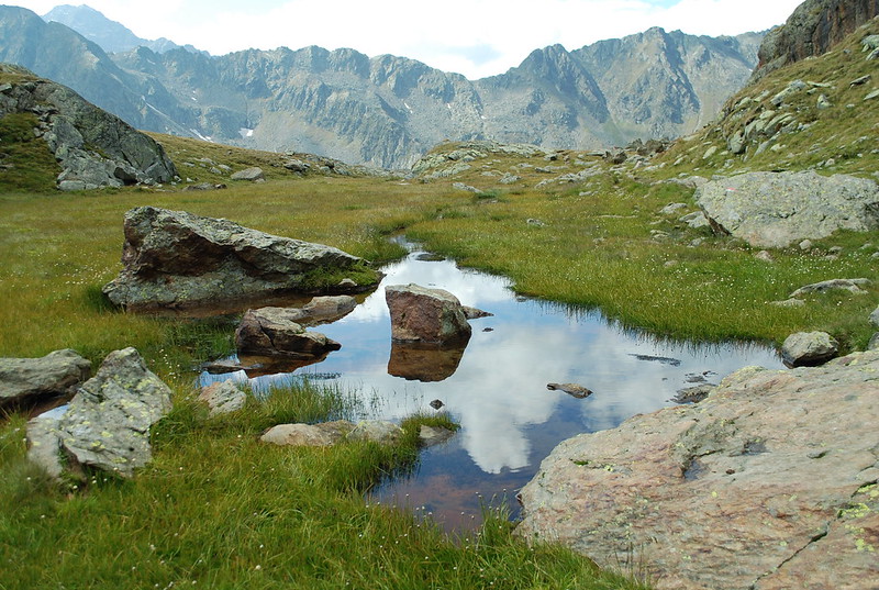
At this point it would be nice to rest and admire the views; but I got off late and I have miles to go before I sleep. But really this is a whole-day circuit, contrary to my blase assumptions of earlier. So, onwards. Pick a random path down the snow and to the pass. Descend. The Paradies is lovely but I've shown you that before; here's a nice still reflecty one in a little pool somewhat higher up:
And so back to the Nurnberger. I set my GPS to recharge - it has about 7 hours in it - and sit out enjoying the sunshine, the Radler, and the Apfelstrudel. Then I have to pack my rucksac, and I reflect that bringing the Macpac as well as the Spire was a mistake: the correct solution would be to be a little more brutal in my packing - fewer clothes for sure, this becomes obvious as I accumulate a bag of stuff I'm using and another, lower, of stuff I just don't use - and then I can save myself another 2 kg by leaving the big sac behind. Farewell to the kindly Guardiennes.
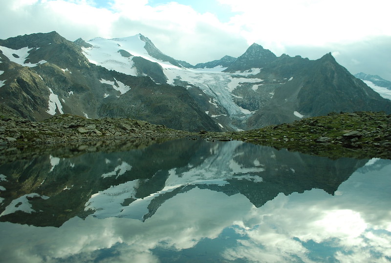
I've agreed to meet M at the Sulzenau. At one point I'd offered to meet her at the Alm at 5; but that's not going to happen: set off at quarter to five, having offered her 19:30 at the Sulzenau by text. From here its a shortish - 50 min - slog up (GPS track) to the Niederl. Pause to admire the bench and the views back towards the Feuersteins - at last, see top. And indeed, over the far side. I get the quasi-classic view of the Wilder Freiger reflected in the lake above the Grunausee:
And thence to the hut: 2:20 total for the crossing. Hello M.
No comments:
Post a Comment