
From the base of the telepherique in Le Tour, looking up to the glacier du Tour. You can't quite see the hut from here. But after the cable car, then the seat-lift, you kinda go round before going up (GPS trace), and can then see...

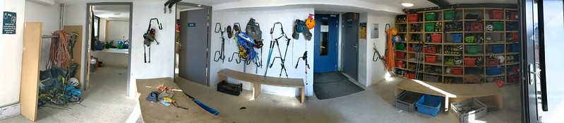
...the hut. The moraine crest points at it; you can see the path traversing in from the left across scree. Inside, it is all nice clean and modern, and apparently run by 17-year-old girls (don't get your hopes up). Here's the boot room.
Being only a couple of hours walk-in from the top of the lift, and a nice hut and well situated, it is popular with the go-to-a-hut crowd; and also features the Aiguille du Tour, one of the easiest peaks in the range. Inside, there's even a comfy sofa and bean bags.

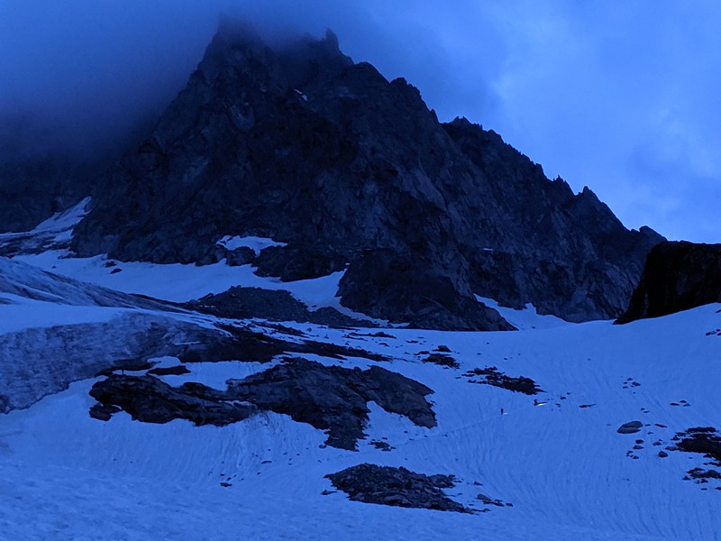
Anyway, next morning we're up at 4, b'fast (bread, not stale, not limited; butter jam; cake-bread; an orange; cereal if you want it; a bowl of coffee for me), off at 5 (having overnight discovered one of the hut's flaws: the windows in the dortoirs don't open much so when it is warm they overheat). There's the usual awkward getting-down-to-the-glacier stuff now all the ice has retreated which takes us 20 mins. We finish gearing up, rope up, and head off into the pre-dawn light. Parties above can be seen by their head torches. GPS trace for the day.
That's kinda the Aig du T ahead. Other folk are going up R past Signal Reilly on the voie normale. But not us, oh no, we're going to head L about where those two are an head up to the col du Midi des Grands (nice view down to people near what I think is the Signal Reilly)...

Once over the col (7 am) you're on the Plateau du Trient, or rather the edge of it, since it isn't terribly flat at that point.

Back to the col, from nearly at the Aig du Tour. The clouds have cleared at this point making everything very much clearer (seriously, before the clouds cleared it was really quite difficult, we couldn't see 20 feet in the cloud). To the R of the col the charmingly named Pissoir. After that - if not too tired - one bumbles up the summit ridge (9 am) easily (diary: "there are some slightly tricky bits but I never stop to put in gear". But you're wondering what it was like. It was like this), and is rewarded with magnificent views.
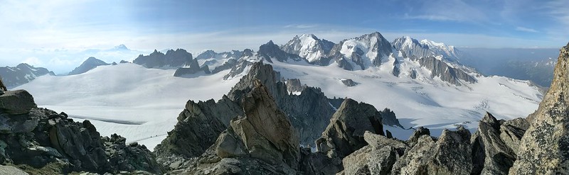
Looking roughly south. Over the glacier, in the center, is the Aig d'Argentiere; to the R of that and closer, the Aig du Chardonnet (closer). Trient plateau to the L. Straight ahead in continuation of the ridge is the Tete Blanche and Petite Fourche, which we'll look at tomorrow. Lurking in the distance mid-left is...

...the Grand Combin, probably. But I'm no mountain-recogniser. Down the ridge again, re-crampon, head round south to the Col Superieur du Tour. The far (west) side is a bit manky scree for a bit (view back to col) then we're back on snow for an easy but long descent - this is the voie normale - back to the glacier and then the hut. 9 h overall.
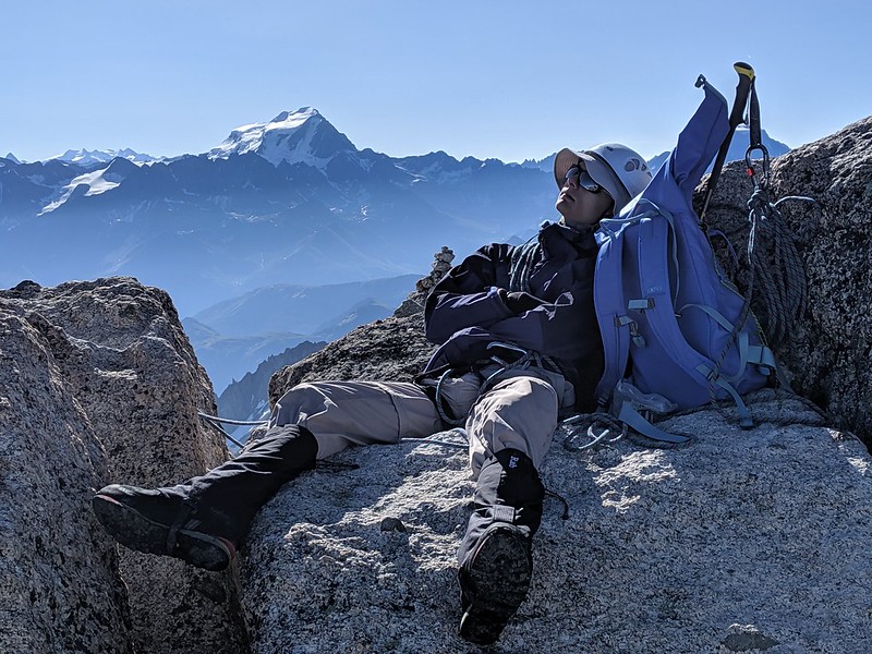
Summit selfie. D and E are modelling Rab.

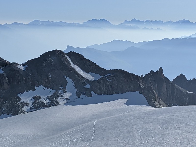
Ethereal clouds across the Chardonnet.

Back at the hut - hello M - it's time for some rest.
Tete Blanche and Petite Fourche
Up early again next day. GPS trace.

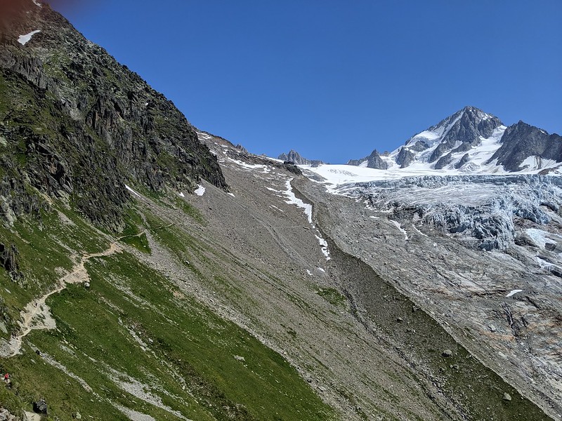
Stuff up the traverse onto the glacier / moraine slightly differently this morning, but it makes little difference. Today is clear, so perhaps overnight has been a little colder, and the snow feels crisper. Head up and the dawn comes. Astonishingly, we're not alone and we're not the first.
We head up, past where we turned off L yesterday and past the Col Sup, and on pretty well to the top of the glacier and the Tete Blanche, which is barely a peak but is a nice viewpoint over Trient.
That shows you the track over the plateau to the cabane and, if you look at the full-size version about the center, also shows you the Cabane de Trient itself. See here for a wider view of the plateau. Looks nice; we should go across some day.
Pano from a bit further along the ridge. The two people just visible on the R skyline are D and E on the Tete Blanche; to their R is the Petite Fourche, our next target; ahead the Trient plateau; to the L on the skyline the Aiguille du Tour of yesterday.

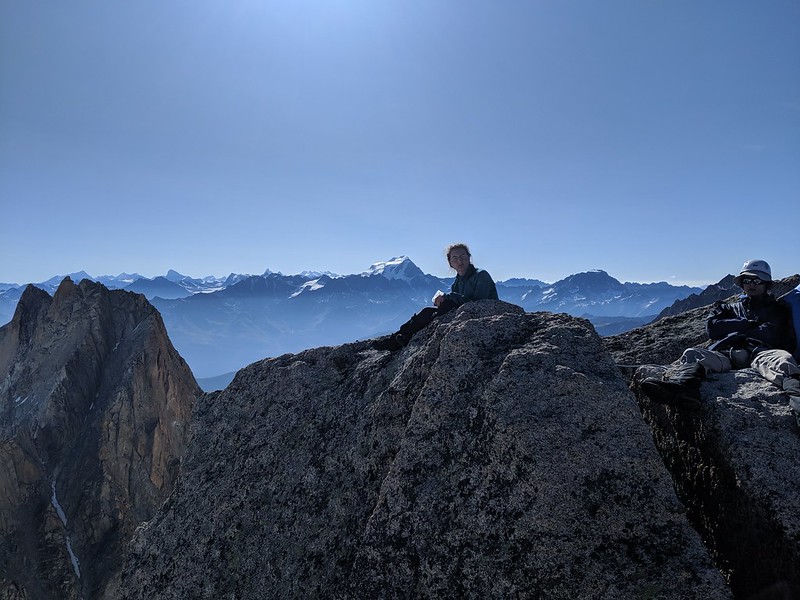
Selfie of us all, I think not taken at the summit, but a little below... ah yes the magic of Google Photos tells me it was taken exactly here. Not that will help you. D looking more sharp-faced than usual?

And to along the ridge to a snow-col, and then up the Petite Fourche. Which is really pretty easy, despite the steeper snow at the top being quite icy. Well, ice really. It's funny how a little change of surface and a little change of angle can makes things harder - or feel harder. But actually you just have to walk on it. Then there's a little bit of rock to scramble up.
At the summit we take a rest and soak up the views. It's a comfortable summit.
And then down. Looking back from a little rock outcropping, probably Pt 3238, Gr F to the R, PF to the L (you climb it from the L). The main track heads off L back to the hut; as you see, there are some differences of opinion as to how to avoid the crevasse zone. But really it hardly needs avoiding.

Back at the hut, some biere:

And now time to pick up M and head down to the valley. Here's a plaque of the hut. And here's looking back to the hut. The path goes down the moraine crest (though we took the snow patch to the left) then heads off left, to the chair lift. Or, if you're hard, continues straight down the crest. Now I look, this is almost exactly the same pic as I took on the way up; but I'll leave it in.
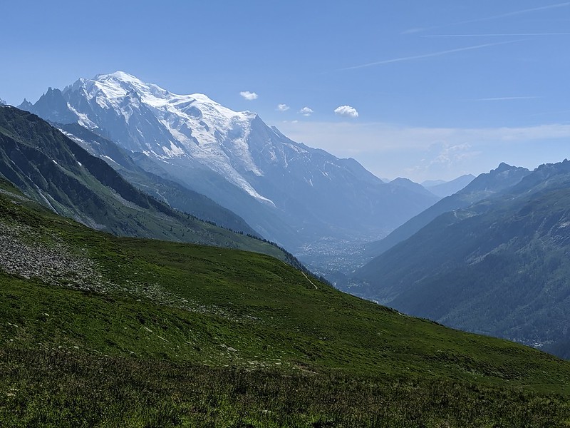
And from a bit lower - before we contour round L to the col de Balme - view down the valley towards Mont Blanc. The clearly visible glacier is Bossons, not Mer de Glace.
No comments:
Post a Comment