Monday 31 August 2015

Book review: Utopia by Thomas More

Available from Gutenberg and discussed on wiki. Most interesting is the question of interpretation, which as wiki says is somewhat problematic:
One of the most troublesome questions about Utopia is Thomas More's reason for writing it. Most scholars see it as some kind of comment or criticism of contemporary European society, for the evils of More's day are laid out in Book I and in many ways apparently solved in Book II. Indeed, Utopia has many of the characteristics of satire, and there are many jokes and satirical asides such as how honest people are in Europe, but these are usually contrasted with the simple, uncomplicated society of the Utopians. Yet, the puzzle is that some of the practices and institutions of the Utopians, such as the ease of divorce, euthanasia and both married priests and female priests, seem to be polar opposites of More's beliefs and the teachings of the Catholic Church of which he was a devout member. Another often cited apparent contradiction is that of the religious toleration of Utopia contrasted with his persecution of Protestants as Lord Chancellor. Similarly, the criticism of lawyers comes from a writer who, as Lord Chancellor, was arguably the most influential lawyer in England.
Some elements do fit with More's known inclinations, and so are presumably what he would like to see: plain clothes, seriousness, principal hobby reading, and so on. His condemnation of lawyers sits oddly with a lawyer; though his main solution is to have less law, and for plain interpretation, an idea that many have shared. Utopia tolerates all religions - but not aetheists, obviously, they are scum; perhaps More secretly wanted toleration, but his faith and his King prevented it.

Utopia is strongly patriarchal - wives obey husbands, of course. There's a brief hint of better: "military exercises and the discipline of war, in which not only their men, but their women likewise, are trained up" but that is quickly thrown away with "that, in cases of necessity, they may not be quite useless". It is also slave owning but - and here we come to the core of the problem with the envisaged society - its a nice slave owning society. Similarly, it has few laws because people are good. It is a society designed to work well when people are good; but as Popper pointed out that doesn't work; you need a society and a political system designed to work well when people aren't good.
 

Sunday 30 August 2015

Stubai 2015

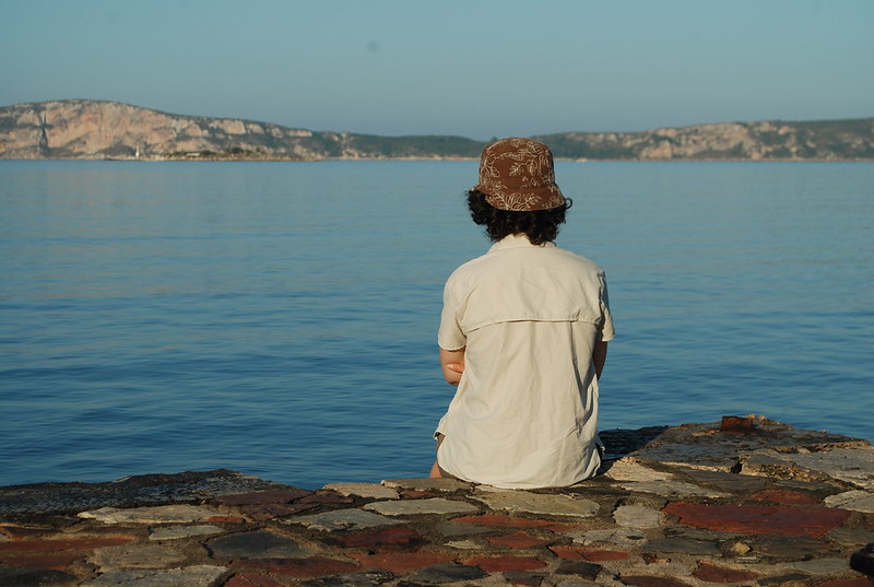
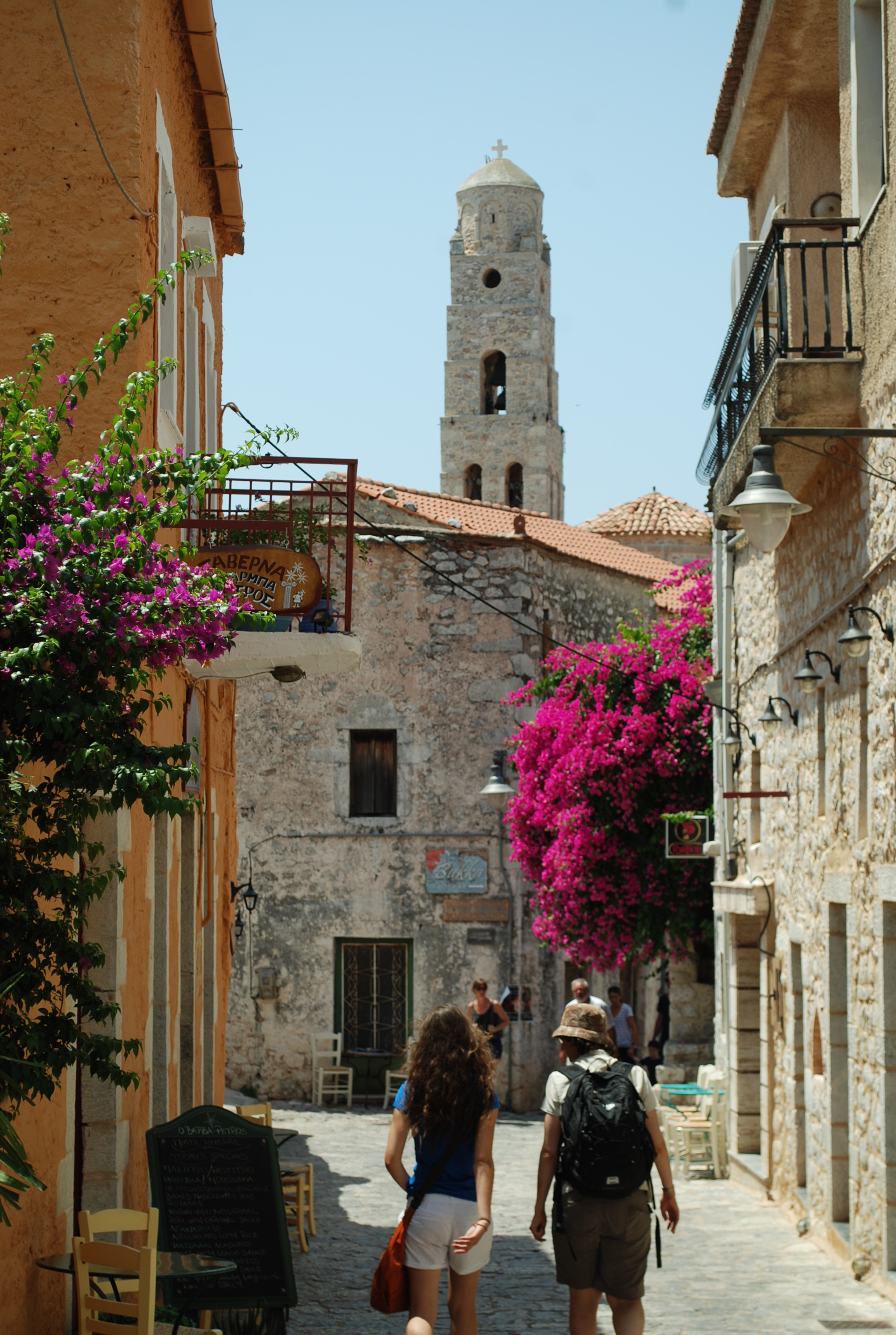
A diary of a week in the Stubai in late August 2015 with Daniel and Jamie. See-also: 2014, which is a far more "pictured" diary of almost the whole valley. This one is rather more terse. Day-links are to the GPS tracks.

Friday 21st: Having packed, caught the train to Gatwick, the plane to Innsbruck, the bus in to the Hauptbahnhof and the bus up to Neustift we called a taxi to get us up to Oberissalm, the road head for the 
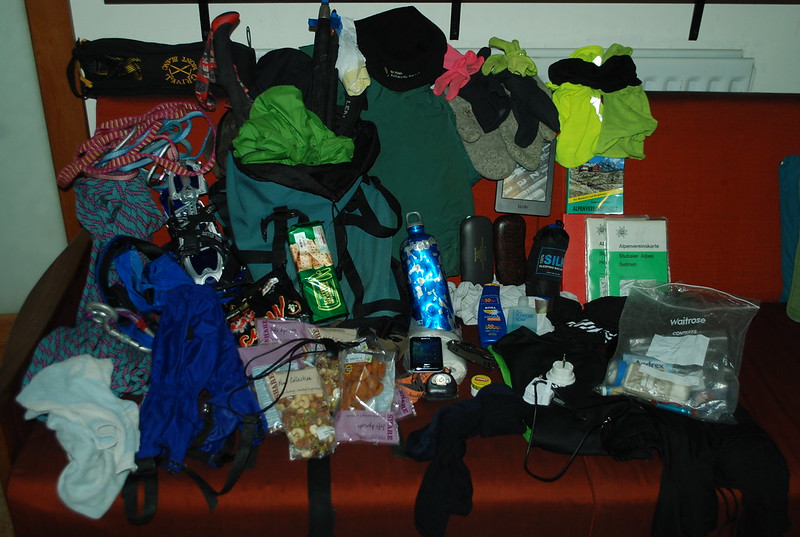
Franz Senn hut. Thanks to D's steaming pace we're up in one hour (book time 1.5) in time for dinner. They're crowded (we're in the FS because the Sulzenau was full) but we get served promptly. We're in box 10 in the loft; pack our sacks for the morning, set the alarm for 6:20, DJ to bed and I sit up over Anthem with a red wine.

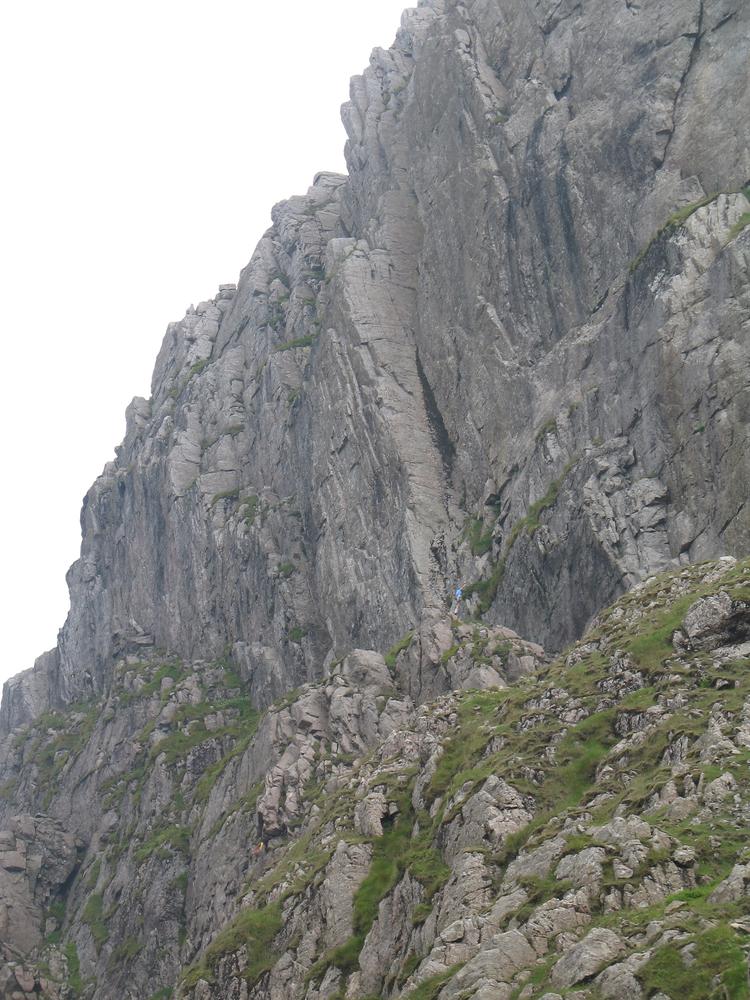
Saturday 22nd (Lisenser Ferner Kogel): An implausible amount of early getting-ready noises woke me earlier, but I slept well. Alarm 6:20, we three up and down to breakfast; I indulge DJ (and hence myself) in the buffet. Wx: sunny, near cloudless. Good for the climb, bad for hut fullness, its already bursting. Set off 7:25 for the Lisenser Ferner Kogel (see post from 2012, unfinished) with several groups ahead, who we overtake, though one gets us back when we rest at the 
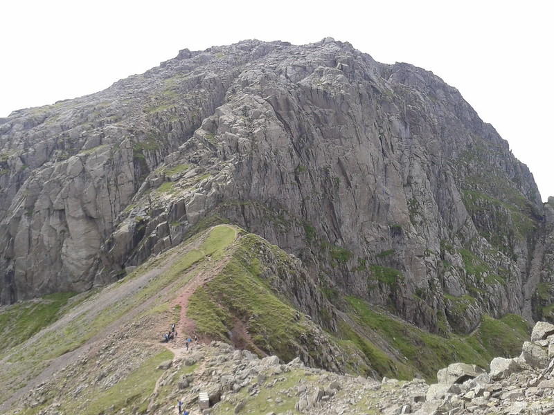
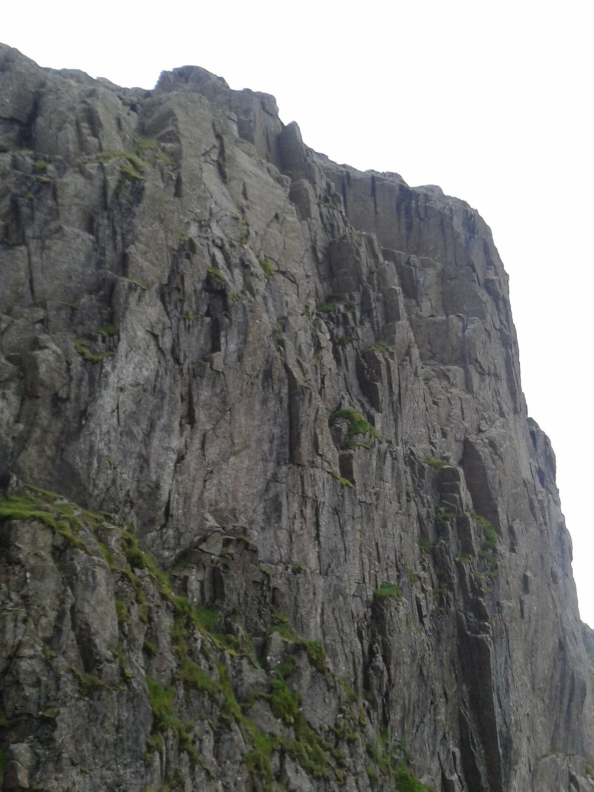
bench. 2h to the Rinnenneider col. From there a surprise, the whole glacier is "dry" - snowless. Down to the glacier edge - further than usual due to lack of snow - and DJ put on crampons (I'd bought a second pair in Keswick but not a third, arguing that anything D or J could do with crampons I could do without, which wasn't quite true but worked out well enough, despite a small amount of blood on the ice). There's a group ahead of us, which is unusual - the twice I've been here before I've been completely alone in the whole basin - but as we cross and then trend up to the Plattigewand it becomes clear they're off to the Lisenser Spitze instead. The Wand is snowless so de-crampon, and so is the top, so there's a slowish rocky section, followed by the glacier to the col and finally snow. Thence scramble up the last 100 m of rocks to the summit. We carried the rope, just in case, but DJ are clearly happy without it. Back to the col, they rest, I zoom up the Rotgratspitze for old time's sake, but its not at all as I remember. Back at the hut by 5 (DJ ten minutes ahead of me) 9:45 total. Sit outside and persuade them to get me a Radler and something for themselves. Tonight's beds end happily: they're still full, so we're in the skiraum, but that's fine. DJ play "slam", D going 5 apricots down to J; I read. They're out of Apfelstrudel so Kaiserschmarren.

Sunday 23rd (Ruderhofspitze): Skiraum was fine, in some ways its more convenient since we're just next to the boot room. About 12 people in there in all. B'fast buffet again, whilst outside a glorious sunrise. Set off at 7:20, 5 mins improvement on yesterday, except I forget my phone so actually just the same as yesterday. Summary: 5h to the peak; 6h back at the col; me back at the hut in 9:30, DJ 20 mins less. Compare 2014, when there was more snow so the glacier was easier. Easily and pleasantly up the valley, then we get to the old / new path choice. Pick the new, since I'm not totally sure the old moraine path can still be used, especially to get onto the glacier; must try it some day. Up by the really very large and impressive waterfall - like so many other things here, it would be the wonder of England were it in England, but here's its just "oh, another massive waterfall" - and we're on the silt plain in front of the very dry glacier; there's no path up onto it despite my feeling there really ought to be one; or perhaps we're supposed to go on the rocks? But never mind, we can force a way. The snout is heavily ablated, caved in, and rock / stone / gravel covered; its a bit tricky sans crampons but I cope. Before the steepening  - which is bare ice - we duck off right onto to the rocks, which is again trackless and much slower than a snowy glacier would have been. One little climb is perhaps slightly more exciting than desired - you don't really want to do Diff in these circumstances - but its brief; and after more circumlocutions and ancillary glaciers we're above the steepening and set off again, and fairly soon the snow starts. Wx is holding - a few clouds - and I'm in the lead initially as I abandoned DJ to put their crampons on. See a party of three descending, but they swing wide to avoid the crevasse zone from the Westliche Seespitze which I realise I was supposed to do, when I look at the map back in the hut; but I'm enjoying my "I know where I am" thing so I'm not looking at it now. The zone is safe, though I need to zig-zag a little; later, we pick up their track. DJ explore a crevasse, then we're at the col. This time there are glorious views across to the Dresdener and down a wilderness of rock and scree to the D-NR path. Embark up the ridge, which as last year looks enormous from here; views this time to my fail of last year, or where it would have come out, I think. DJ cope perfectly well and soon we're at the top: Berg Heil! Stop at the top for 20 mins to take pics, sign the book, and fall asleep; then head down. Rest at the col and finish off lunch (breakfast buffet allows you to make sandwiches for lunch!). Down, letting DJ leap ahead. Above the steepening take a bit more care exactly where we're going on the rock and do it better. Back on the ice for the descent to the snout via views of various increasingly large sinkholes; we're all cramponless now. Back to the silt plain, end up leaping some of the streams, and thence to the hut. They're resting outside when I turn up, and D buys me a Grosses Radler again. A second long day. To bed early, before 9; in the dorms again, since the hut is not full on Sunday evening.

Update: I realise, when writing this up, that I missed a trick: its possible to descend from the Ruderhofspitze to the Neuregensburger. Either by tracing the ascent route I failed on last year (somewhat dodgy, as I've never done it) or by crossing the Hochmoosscharte between the R and the Westlicheseespitze. Which I haven't done either. So, even if I'd thought of that, we probably wouldn't have (we'd have had to carry all our kit, too). But it would have been worth a think. And would be cool to do!

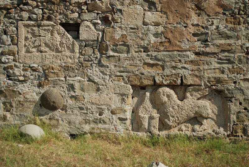
Monday 24th: We want to get to the Sulzenauhutte. As it much later transpires, the best thing to do would have been to cross to the Neuregensburger, then go into the valley and out again to the S, taking two days; those would have been our mid-trip rest. However, that would have taken up our last spare day so instead we're going back to the Oberissalm, taxi to Neustift, bus up valley, and walk up to S. Or so I'd planned. Wake 6:20 for the practice, preceded by comedy of the Russian guy who couldn't turn his clock-radio off; have kleines fruhstuck because we can eat lunch in the valley; D repairs his heel which had rubbed somewhat yesterday, possibly because it had got wet in the stream under the crevasse, and off. Wx is grey, but the peaks are clear, so that'll do; tomorrow's forecast is rain. We get down quite quickly, DJ leading. I call a taxi but he can't make it for half an hour... or an hour... or maybe two. I say I'll call back and we go to the Alm cafe. DJ realise that they've both left their towels, and J has left a base layer, so D is dispatched back to get them (after first being allowed a drink), and given about an hour and a half; this seems to fit, I'll call the taxi when he's back. D does come back in time, J and I sit in the sunshine in the cafe in the interim, its a hard life. We miss the "real taxi" which had brought someone up; but the "Alm taxi" is there so take that. Half way down the driver casually asks if I'd rather go straight to the S start; and without thinking much I say yes; we'll miss lunch in town but meh. It turns out moderately expensive - E85 - but never mind. Its now sunny so up we head, DJ in the lead, and I'll stop saying that because they always were. We meet up at the half way Alm and have bier and Fanta, and I re-admire the old carvings. After a nice rest on to the top in less than an hour, with views back through rainbow as there is a fine rain. The rebuilding is done (entrance way reshaped and the common room gains an extra room), but the inside is not yet quite back the the "gemütlich" it once was. Lunch: Tiroler Grostl for DJ, wurst-n-brot for me. Shower, E2, via token; the shower room is rebuilt and much better. Afternoon: read, cards, stare at weather which is clear and windy but clouds at 2800 m. Dinner: two knudeln for me again, but the Sulzenau style is different. Pudding: GermKnudlen, which we find a challenge. Talk: Ladakh, the not-summit day, and should they have tried anyway? But the risk of avalanches. And discuss the rapid evacuation when people got sick. Knock-out whist from 17: D wins.


[TO BE CONTINUED]

Book review: Anthem by Ayn Rand

Anthem is more of a short story or fable than a book; think of it as a very condensed Atlas Shrugged if you like. Read about it at wiki or read it at Gutenberg. It is a paean to the virtues of individualism and a polemic against the evils of collectivism.

Summary: our hero lives in a society where the word "I" is unknown, as are individual names; he grows up lively, interested, and questioning but is assigned the trade of street sweeper. By native brilliance and a chance discovery of ancient relics in a subway tunnel he rediscovers electricity as a source of light; when he shows this to the college of scholars they are appalled: it might put the candle makers out of business. After an obligatory torture scene - in Rand, the state must be physically violent, no matter how little it fits - he runs into the wilderness, followed by the noble upright "Golden One", a woman as unbent as him. But naturally her only desire is to obey him, and subsequently have his babies. After wanderings they find an abandoned house from The Old Times on top of a mountain; he learns to read while she admires herself in the mirror; he determines to rebuild society, starting with his infants and those from his old city not crushed.

Refs


* Dual Anthems by Bryan Caplan

Muller hutte

The Muller hutte (3145 m) is a high mountain hut between the Wilder Freiger and the Wilder Pfaff / Zuckerhutl, only accessible by glacier. Being high, and relatively small, it doesn't have quite the same range of facilities as others; but it has a common room with a stove, and drying room, and will provide food though not a-la carte.

Pix

* Common room

Some of my posts involving the hut

* Stubai: Wilder Freiger to the Muller Hutte (2014)
Wilder Pfaff and Zuckerhutl (2014)

Hildesheimer hutte

The Hildesheimer hutte is between the Dresdener and the Muller, in my world; or between the Hochstubai and the Siegerlander in the Solden-side touring world. Its a nice old hut,the staff are good,and the views are wonderful.

[TO BE EXPANDED]

Thursday 20 August 2015

Stubai: packing list 2015

This year's list bears an uncanny similarity to last year's list. Except: there are three of us going, so add rope and harness for glacier travel, and since I have those a few slings for tokens like gear on the Zuckerhutl even though I know I won't need them, but they're only 400 g in total.

So, what can we see? Don't say "nothing, its all black". I'm sorry about that.

DSC_5394

In the rucksac, three ice axes (two walking, one climbing) one for each of us, and three ski poles (between D and me; J has his own). Peeking out, my thin "waterproof".

New this year, some food, probably too much, never mind we can just eat it: two each of mixed nuts, dried apricots, mixed raisins, about 200 g each; a pack of shortbread; and eight Mars bars.

To the left, my gaiters, two pairs of crampons: mine from last year, D's new aluminium pair, to be shared with J according to conditions, my nice 50 m blue half-rope, two harnesses (J to bring his), a towel.

To the right, my green "waterproof" trousers mostly for warmth, BAS fleece hat, spare bin liner, water bottle, phone, toilet paper part-roll, phone, head torch, watch charger cable, D's penknife, lip salve, spare glasses and glacier glasses, sun cream, soap, USB plug, foreign adapter, silk liner, various black tee-shirts (not too many), underpants times two, one pair tracksters and one pair long johns, bag of misc like compass and whistle, maps, red diary, Alpeinvereinsfuhrer, Kindle, gloves: Dachstein, fleece, thin; neck warmers times two and "silk" balaclava.

Add money-tickets-passport-EHIC-boarding passes and we're about there. No SLR this year, I'm being very brave.

Wednesday 19 August 2015

A day in the lakes with Daniel

We went up to Annie's for a few days, just prior to Daniel, Jamie and I heading off to the Stubai, and it seemed a good idea to test his - and my - fitness, and to have fun. So Scafell was a good choice, in why case why not try something on Central Buttress? I've been thereabouts many years ago in the company of Jim Lind (and Wiz aka Liz Pasteur), and one other I forget, sorry, actually I'm sure Miriam was there too. Maybe it was the four of us.

Anyway, here's the GPS trace (up only, because my watch ran out; but we retraced our steps nearly so down would be dull. My previous trace from 2010 shows a possible circuit of Scafell Pike). The only minor route notes are (a) if you're really only interested in the climbing, start from Wasdale, its much quicker; (b) if you really want to start from Seathwaite, make sure you get there early enough to park close to the farm; (c) if, having gone that way, you don't want to actually climb Scafell Pike you can save yourself 40 m by cutting off the summit, but you'll need to not just follow the path; (d) pay attention in a couple of places to where you leave the path; the OS map is your friend.

D and I walked up in mostly companionable silence; we talked a little, but not nearly as much as the people we overtook. We stopped very briefly a couple of times. We're about the same speed; D, untethered by me, would be a little faster. From the top of Scafell Pike we got our first views of the crag.

2015-08-18 13.10.41

The book says you descend by doing -blah- and then abseiling off something. I was a touch vague about that and intending to wing it; next time I go there I think I'd chose any easy short climb to familiarise myself with the rock, and the desent route, so I didn't have to worry about it. That's an excellent motto for all crags on your first time I think. In retrospect.

And here's from closer in, though its not desperately useful as the slabs face the other way so all you can see from this is their edges, if you see what I mean.

2015-08-18 15.56.09

I now find myself somewhat confused about exactly where we got to. You see from the first pic how the eroded path along the ridge meets the rock. Then you follow it down (at first steeply on yucky fine scree) to the obvious path along the base of the crag. From there, getting up to the base of the climb is non-obvious. We (we? Don't blame D for any of this; *I*) chose to just scramble up the rock-n-grass; when we descended, it was clear that a better way was following the rough grass ledge ("Lord's rake") to the right (facing in) which is much easier and doesn't need roping.

This is a better view of the climb itself.

We did the first, easy, 4b pitch fine. There's a small but perfectly adequate stance. Even at this point the gear isn't super, so I flung the rope over a nearby boulder which (I was pleased to see) has a large loop of rope over it for convenient abseil if you wimp out of the second pitch.

Starting up the second, 4c pitch, I began to wonder exactly why I thought I was capable of VS 4c at this point in my career, beyond a vague memory that Wales (and Lakes? Not sure) grades tend to be easier than Peaks. Suffice to say that didn't prove adequate. Moving upwards was working OK but the absence of gear, or of  gear I was sure I trusted, was proving worrying. Take more quick-draws, and make sure your wires are in order. At some point - probably about half way up the second pitch, with no clear end in sight and a slight steepening in prospect - I decided that wimping out was a good idea, and abbed off a nut I've never really liked but which was pretty firmly in place for a direct downwards pull. And then - after a slight farce straightening out the ropes - we abbed off the in-place tat (D first, off our gear, me second, off the tat, having verified it was OK). The rock and the line, though, were gorgeous; I'd love to have another go when I'm better.

And so back; it got a leetle bit long towards the end; a gentle rain cooled us without really wetting us.


Tuesday 4 August 2015

The Peloponnese, 2015

peloponnese_2015 Last year we went to the Peloponnese, and enjoyed it. So this year we went again. With some differences; Daniel was elsewhere; and this year we felt less obligation to go and see things, and were happier to relax. My public blog has some very minor notes on the economic crisis, which I won't repeat here.

 Instead, this will be a "photo essay", which is to say, I won't bother write many words. The map shows last years stops in red, and new ones this year in purple.

This year we started with three days, extended to four, in Gialova (West coast, between Chora and Pylos) which is where we ended up last year. Then to Mythras for two days; then a day apiece in Gythio and Stoupa.

Gialova


We stayed at "Zoe". We spent a lot of time between the cafe and the beach, reading and playing cards (mostly "hearts" and some "gops").

DSC_5161

Or watching Navarino Bay or Sphacteria.

DSC_5177

Or swimming in the sea or the pool.

DSC_5187

You get the point, I'm sure. We didn't do much.

Methoni


However, we did visit Methoni, which has an enormous Venetian / Turkish castle.

DSC_5150

Walking towards the "Bourtzi".

DSC_5122

The Bourtzi itself.

DSC_5128

I told you it was Venetian.

DSC_5119

Castle from Bourtzi.

DSC_5134

Old main square.

DSC_5142


Across the Taygetus


From Gialova we drove back to Kalamata (ignoring the comedy diversion to ancient Messene, which failed) and over the Taygetus to Mystras.

DSC_5188

There aren't many cafes en route. Grab one where you can. Note remains of force-driven water wheel.

DSC_5191

We found a nice green glade.

DSC_5196

In Tripi, Miranda was delighted to get a chip omelette.

DSC_5203

Mystras

Mystras is a Byzantine / Venetian / Ottoman ruined city overlooking the plain of Sparti. The ancient Spartans left little behind but a legend, so overlooking it is the best thing to do.

DSC_5207

Mystras is a large site, spread over several levels. We started at the top; achronistically, here's looking up. Wider view.

DSC_5244

Looking down from the upper (castle) to the middle (palaces).

DSC_5213

Somewhere in the middle with Miranda...

DSC_5220

Out into the misty hills.

DSC_5251

They still take their religion seriously. Most of the restored buildings are churches, which I think somewhat biases the appearance of the site.

DSC_5253

The eye in the pyramid wings. There are lots of murals, but mostly faded. If you like murals, take care to research beforehand where the ones you should look at are.

DSC_5256

View from the plain. I was trying to not take too many pix, honest.

DSC_5261

Gythio


From Mystras we drove down into Sparti, but didn't stop. There are a small number of antient objects nearby, but poorly signed.

DSC_5281

Through the olive groves...

DSC_5280

To the tholos tomb. You could argue this wasn't so exciting, but the setting made it.

DSC_5278


And so on to Gythio. Whose website helpfully says There are not realy mentionable ancient objects to be studied in Gythio... So, every visitor is free to enjoy just greek present life. Stereotypical boat pic.

DSC_5283

They had some lovely flowers. Name?

DSC_5294

In fact we were 4 km out from Gythio, along the beach strip. The grass was unreal, though actually real grass.

19616223253_e530f628b9_o

Stoupa


From Gythio over the hills; skirting the south end of the Taygetos.

DSC_5306

Suddenly there was an enormous Ottoman castle. Don't stay in the car, its cooler up top in the breeze.

DSC_5309

Then Aeropoli. We spent most of the day in this taverna. Fried feta with honey and sesame was Miranda's favourite of the holiday; mine was aubergine; M's, perhaps, Greek salad.

DSC_5330

Aeropoli is pretty in the old bit:

DSC_5325

There was an exhibition of pictures. We bought one:

DSC_5370_crop

Also a stairwell that might have been art. But probably wasn't. And a very stern goddess of victory. And the church probably had a Gabriel like ours on its lintel. You can buy old houses.

Then to Stoupa. Our appartment was unexciting but fine for a night. One last game of "hearts" overlooking the beach.

DSC_5354

Next day: the road back to Kalamata:

DSC_5367


Boring travel notes


If you're booking hotels or appartments on the fly, you're probably using booking.com or somesuch, and you'll discover that they're all along the coast, apart from a few at places like Mystras. There are none at ancient Messene. Which is  shame. I wish I knew of one there. What I'm trying to say is, if you want to stay in the interior, you'll need to plan it a bit and/or work harder.

In the summer, its hot. Really. If you think that getting somewhere at 10 will still leave you the cool of the morning, you're wrong. Even 8 am is likely to be really quite warm. The sea takes the edge off, of course, as does a breeze.

Mystras: we stayed at Mazaraki guesthouse: good views overlooking the plain of Sparti and over to the fortifications of Mystras. Mystras itself is a multi-level site; you get a choice of upper or lower gate. There's a fair vertical gain between the two which you do not want to do in the heat of the noonday sun. Or, likely, at all. We did upper one evening and lower the next morning.

Booking.com: note that the ratings given (e.g. "Exceptional, 9.5" for the Mazaraki) don't compare to star ratings for hotels; in my opinion, they're inflated.

The coastal road, Gythios to Stoupa, is slow. If you've going to Kalamata, the maps would rather send you via Tripolis :-).