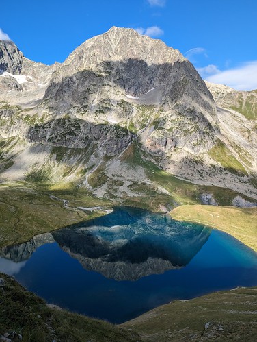
The saga...
Endless vacillation eventually collapses, wavefunctionlike, into a 8:01 Eurostar out of London on Monday the 31st of July, with a 5:39 train from Cambridge to get me there. From there, Gare de Lyon (14:20) to Grenoble (17:20), and then plan a bus to Bourg d'Oisans or similar.
Here's a GR54 Tour d'Oisans map; here's my merged GPS track. Here's a useful info page.
Write up:
* part one: Bourg d'Oisans to Vallouise
* part two: around Vallouise and Ailefroide
* part three: Ailefroide to Les Deux Alpes
* part four: Les Deux Alpes to La Berade; around; Dibona; and to Bourg D'Oisans
* part five: Belledonne
2021's in-arrears
kit list: gaiters; crampons; boots; light axe; trekking poles; knee brace; waterproof/warm trousers; maps (bought out there); socks; hat; helmet; headtorch; water bottle and baby bottle; lighter; toothbrush; silk inner; carry mat; down jacket (yellow bag); sleeping bag (black bag); green raincoat; plasters etc; sunglasses; tarp; thermarest; cooking kit; electronics (battery pack; wires); misc in lightweight red rucksac; gloves (thin; fleece; down mittens-and-outer-mittens).
The vacillation hasn't quite collapsed enough but I think I'm going to omit crampons and axe and helmet, and cooking kit, and gaiters.
Here's my sum-total track, for five weeks in the Ecrins+Belldone: 650 km, 175 hours "moving time", +36,776 m.

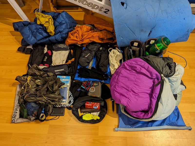
So this years list is: boots; trekking poles; tracksters; under trousers (HH black); maps; socks x 3; underpants x 2; yellow thin top; new Rab shorts; hat; headtorch; water bottle and baby bottle; toothbrush; silk inner; carry mat; down jacket (yellow bag); sleeping bag (black bag); orange raincoat; plasters etc; sunglasses; tarp; thermarest; electronics (battery pack; wires); misc in lightweight blue rucksac; gloves (thin; fleece; down mittens-and-outer-mittens).
Here' a rough kit picture; here's the better one. Note the new coat. Rucksac (per France 2019) was an EXPED Black Ice 45. I didn't take the Concept2 :-).
Tarp
I'm not taking a proper tent, or a bivvi bag. Instead I have a lightweight tarp (Rab Element Solo). This is good enough for "normal" weather. My plan for heavy rain or other bad weather is to stay in a refuge, or find some other shelter, or just survive.
Whether to stay in refuges or camp out is a perennial question. Refuges get you a lighter pack: you can omit all the tent, sleeping back and even food if you want. It doesn't even have to cost much: if you have a reciprocal rights card, then sleep-only in a typical CAF refuge is E10.50. But it does mean you have to book ahead, against the possibility of the refuge being full (this rarely happens and even if they are "full" they will generally put up a distressed traveller). And I hate booking ahead. Sleeping out gets you all the joy of sleeping out: freedom from the snorrers, and the stars wheeling above you.
Food and drink
I didn't carry a stove. This saves weight and hassle, at the cost of giving you nothing to do at the end of a long day except stare at the mountains (but I have a Kindle). Slightly more seriously, I doubt that for most purposes a stove is genuinely useful; most of the cooking that people do is really only to fill in time and prevent boredom. As an alternative to pasta, bread will last a few days quite happily, or crispbread type stuff, or oatcakes (a good test of hunger: are you hungry enough to eat an oatcake?). FWIW, I drink without fear from streams high up in the Alps, where high up is loosely defined as above the cow line, above 2000 m say; but I don't offer that as advice.
Footwear
I took a perfectly decent pair of boots, but in the end I mostly wore trainers. A month of rough trails and rocks was not good for them, but they were light and comfy and if you're delicate with your feet they're good enough grip on most trails. They're not at all waterproof, but then again they dry quickly. Probably I should wear my trail shoes instead but I didn't think of that.
GPS tracks
I obsessively track my routes with GPS. Usually I do this on a GPS watch (Garmin 620) but I'm finding after several years of use that the battery doesn't last as long as it used to, and certainly not a day. After initially breaking into segments I eventually realised it was more sensible to use the phone GPS, recording with the Strava app. As a bonus, this gave me a real time track. Update: but this does drain the phone battery somewhat; and having "upgraded" my watch
to the 55, the battery now easily lasts all day.
 The saga...

No comments:
Post a Comment